


Click Image to Enlarge
Texas Counties
Texas is divided into two hundred and fifty-four counties, more than any other state. Texas was originally divided into municipalities, a unit of local government under Spanish and Mexican rule. When the Republic of Texas gained its independence in 1836, there were 23 municipalities, which became the original Texas counties. Many of these would later be divided into new counties. The most recent county to be created was Kenedy County in 1921. The most recent county to be organized was Loving County in 1931Panola County, Texas
Panola County Education, Geography, and History
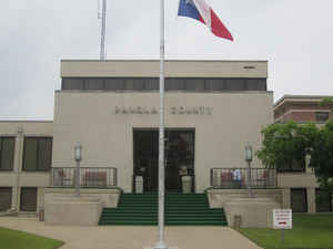
Panola County is a county located in the state of Texas. Based on the 2010 census, its population was 23,796. The county seat is Carthage. Located in East Texas, the name of the county is derived from a Native American word for cotton.
Etymology - Origin of Panola County Name
a Native American word meaning "cotton" (an early cash crop in the county)
Demographics:
County QuickFacts: CensusBureau Quick Facts
Panola County History
Panola County was formed in 1846 from sections of Harrison County and Shelby County. It was named after a Choctaw/ Chickasaw word for cotton
Handbook of Texas Online
In 1840 the boundary between the Republic of Texas and the United States (the
line that later became the county's eastern boundary) was settled. The Sabine River was established as the boundary
south of the thirty-second parallel, but it was necessary to send a commission of representatives from both
countries to survey the line north of the parallel. On April 23, 1841, the commission set a granite marker at the
location of the thirty-second parallel, 100 feet off present State Highway 31. The western side of the shaft was
inscribed with the letters "R. T." (for Republic of Texas); the eastern side was inscribed "U. S." and the southern
side, "Merid, Boundary, Established A.D. 1840." The marker, the only one of its kind, still stands on the line
between Panola County and DeSoto Parish, Louisiana. In the early 1840s a feud erupted between two factions who
called themselves Regulators and Moderators. For almost four years skirmishes extended from Harrison County and the
Caddo Lake area through Shelby and San Augustine counties and into Sabine County. The so-called Regulator-Moderator
War grew out of the unsettled border conditions; the Neutral Ground furnished a
secure residence for lawless men, and their activities caused the growth of vigilante groups. The warfare ended in
1844, when President Sam Houston ordered out the militia to stop it. On March
30, 1846, the Texas legislature established Panola County from parts of Shelby and Harrison counties. John Allison,
the county's first chief justice, had been a slave owner and cotton planter in Panola County, Mississippi; he may
have been the one who suggested the name Panola to Isaac Van Zandt, the author
of the act that established the county. Because the legislature specified that the county seat was to be within five
miles of the center of the county, it took two years for the county to choose a permanent seat of government. Only
two real villages, Pulaski and Grand Bluff, existed in the area in 1846; both were ferry towns on the Sabine River.
Both were also more than seven miles from the center of the county. Nevertheless, commissioners appointed to choose
the two most desirable locations for the county seat selected Grand Bluff and Pulaski to compete for the county seat
in a public vote. Two elections were held in the summer of 1846. County officials were elected on July 18, and a
second election on August 23 chose Pulaski, by a small majority, as the county seat. The first court session met
there on September 9. After dissatisfied citizens challenged the legality of the choice, Chief Justice Allison ruled
that Pulaski would be the temporary county seat until appeals could be examined and an official legal decision made
by the state legislature. Since neither village satisfied the legislature's requirements, the entire procedure had
to be repeated. Pulaski and an uninhabited townsite later called Carthage near the center of the county were
nominated for county seat. In an election held in August 1848 the voters of the county chose Carthage. New county
officers were also elected, and Chief Justice Thomas G. Davenport met with his first court session at Carthage on
September 12. At that time, Carthage was little more than a location in a virgin forest of short-leaf pine, oak,
hickory, and dogwood. The site was a mile west of the center of the county in order to use high well-drained ground.
Spearman Holland was credited with naming the town Carthage, after his former
home in Carthage, Mississippi. Jonathan Anderson, who lived four or five miles
southeast of the site, owned the land and offered to donate 100 acres for the town. In 1848, when the commissioners'
court met for the first time in the new location, he deeded the 100 acres to Panola County. The legislative act
authorizing the county specified that the county seat be laid out into convenient lots with space in the center to
erect a courthouse. Lots were staked out and sold at public auction; the proceeds were to be used to construct
public buildings. The county government was dependent upon the Panola County Commissioners' Court, which was
responsible for overseeing road construction, for setting ferry fees, for law enforcement, and for other business
concerning the general public More at
Leila B. LaGrone, "PANOLA COUNTY," Handbook of Texas Online (http://www.tshaonline.org/handbook/online/articles/hcp02),
accessed January 24, 2016. Uploaded on June 15, 2010. Published by the Texas State Historical Association.
Geography: Land and Water
As reported by the Census Bureau, the county has a total area of 821 square miles (2,127 km2), of which, 801
square miles (2,074 km2) of it is land and 20 square miles (53 km2) of it (2.49%) is water.
Neighboring Counties
Bordering counties are as follows:
- Harrison County (north)
- Caddo Parish, Louisiana (northeast)
- De Soto Parish, Louisiana (east)
- Shelby County (south)
- Rusk County (west)
Education
The following school districts serve Panola County:
Beckville ISD
Carthage ISD
Elysian Fields ISD (mostly in Harrison County)
Gary ISD
Joaquin ISD (mostly in Shelby County)
Tatum ISD (mostly in Rusk County)
Tenaha ISD (mostly in Shelby County)
There is also Panola College, a junior college, which has operated in Carthage since 1947.


Click Image to Enlarge
