


Click Image to Enlarge
Texas Counties
Texas is divided into two hundred and fifty-four counties, more than any other state. Texas was originally divided into municipalities, a unit of local government under Spanish and Mexican rule. When the Republic of Texas gained its independence in 1836, there were 23 municipalities, which became the original Texas counties. Many of these would later be divided into new counties. The most recent county to be created was Kenedy County in 1921. The most recent county to be organized was Loving County in 1931Red River County, Texas
Red River County Education, Geography, and History
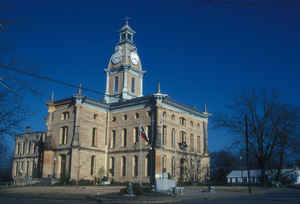
Red River County is a county located in the state of Texas. Based on the 2010 census, its population was 12,860. Its county seat is Clarksville. The county was created in 1835 and organized in 1837. It is named for the Red River, which forms its northern boundary.
Etymology - Origin of Red River County Name
the Red River, which forms its northern border
Demographics:
County QuickFacts: CensusBureau Quick Facts
Red River County History
Red River County is a county located in the US state of Texas. It is named for the Red River, which forms its
northern boundary. Its seat is Clarksville.
Handbook of Texas Online
During the First Congress of the Republic of Texas, the Red River district
was little more than a vaguely defined area encompassing all or part of the land of thirty-nine present counties.
Red River County was formally delineated by an act signed by President Sam Houston
on December 14, 1837, which divided the Red River District into two counties, Fannin and Red River. Red River
County, as defined by the 1837 act, included all or part of lands now belonging to Lamar, Hopkins, Delta, Franklin,
Titus, Morris, Cass, Marion, and Bowie counties. The act called for the first county courts to be held at LaGrange
(later Madras) until a commission to be appointed by the county court could ascertain the proper location for a
county seat. When the commissioners chose Clarksville in 1838, some residents of LaGrange tried unsuccessfully to
reverse the ruling. New counties established in 1840 and 1846 reduced Red River County to its current size. From its
founding the county grew in population slowly but steadily. By 1860 residents numbered 8,535. As in many other parts
of North Texas, problems with adequate transportation probably served to inhibit the county's growth. The Red River
was generally navigable for a part of the year, but when the river was low, produce and supplies had to be hauled to
and from Jefferson, 100 miles to the southeast. The population of the county was overwhelmingly rural. More at
Cecil Harper, Jr., "RED RIVER COUNTY," Handbook of Texas Online (http://www.tshaonline.org/handbook/online/articles/hcr05),
accessed January 24, 2016. Uploaded on June 15, 2010. Published by the Texas State Historical Association.
Geography: Land and Water
As reported by the Census Bureau, the county has a total area of 1,058 square miles (2,739 km2), of which,
1,050 square miles (2,720 km2) of it is land and 7 square miles (19 km2) of it (0.70%) is water.
Neighboring Counties
Bordering counties are as follows:
- McCurtain County, Oklahoma (north)
- Bowie County (east)
- Morris County (southeast)
- Titus County (south)
- Franklin County (southwest)
- Delta County (southwest, a very short border)
- Lamar County (west)
- Choctaw County, Oklahoma (northwest)
Education
The following school districts serve Red River County:
Avery ISD
Clarksville ISD
Detroit ISD
Prairiland ISD (mostly in Lamar County)
Rivercrest ISD (partly in Titus County, small portion in Franklin County)


Click Image to Enlarge
