


Click Image to Enlarge
Texas Counties
Texas is divided into two hundred and fifty-four counties, more than any other state. Texas was originally divided into municipalities, a unit of local government under Spanish and Mexican rule. When the Republic of Texas gained its independence in 1836, there were 23 municipalities, which became the original Texas counties. Many of these would later be divided into new counties. The most recent county to be created was Kenedy County in 1921. The most recent county to be organized was Loving County in 1931Runnels County, Texas
Runnels County Education, Geography, and History
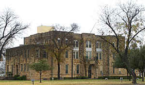
Runnels County is a county located in the state of Texas. Based on the 2010 census, its population was 10,501. Its county seat is Ballinger. The county was created in 1858 and later organized in 1880. It is named for Hiram G. Runnels, a Texas state legislator
Etymology - Origin of Runnels County Name
Hiram George Runnels, the ninth governor of Mississippi and planter in Texas
Demographics:
County QuickFacts: CensusBureau Quick Facts
Runnels County History
Runnels County is a county located in the US state of Texas. I Its seat is Ballinger. The county is named for Hiram G. Runnels, a Texas state legislator.
Handbook of Texas Online
Although the area was still sparsely populated, the demands of the advancing frontier were such that on February
1, 1858, the Texas legislature established twenty-three new counties. One of these was Runnels County, named in
honor of Hiram G. Runnels, an ex-governor of Mississippi and a Texas state
legislator. The county was carved from Bexar and Travis county lands. The first civilian settlement in Runnels
County, Pickettville, was established in 1862 by Mr. and Mrs. John Guest and their three sons, Henry and Robert K.
Wylie and their cowboys and a black servant, and Mrs. Felicia Gordon and her
five sons. This small group was joined shortly thereafter by Richard Coffey and
his family near the site of present Ballinger. Pickettville lasted only a few years; by 1866 it had been abandoned,
as the families moved their stock out into the open range. During the 1870s the rich grasslands of Runnels County
attracted more and more stockmen who were willing to risk Indian attacks. By 1876, after the Texas Rangers
and United States troops such as those led by Col. Ranald S. Mackenzie had
broken Indian resistance and driven them into Oklahoma, settlement began in earnest. In the late 1870s and early
1880s cattlemen, mostly from the southern United States, took possession of Runnels County, establishing camps along
the Colorado River and its tributaries. Runnels County was organized in February 1880 and had a population of 980.
It had no towns, only scattered settlements More at
Kathryn Pinkney, "RUNNELS COUNTY," Handbook of Texas Online (http://www.tshaonline.org/handbook/online/articles/hcr11),
accessed January 24, 2016. Uploaded on June 15, 2010. Modified on July 25, 2012. Published by the Texas State Historical Association.
Geography: Land and Water
As reported by the Census Bureau, the county has a total area of 1,057 square miles (2,738 km2), of which,
1,051 square miles (2,721 km2) of it is land and 6 square miles (17 km2) of it (0.61%) is water.
Neighboring Counties
Bordering counties are as follows:
- Taylor County (north)
- Coleman County (east)
- Concho County (south)
- Tom Green County (southwest)
- Coke County (west)
- Nolan County (northwest)
Education


Click Image to Enlarge
