


Click Image to Enlarge
Texas Counties
Texas is divided into two hundred and fifty-four counties, more than any other state. Texas was originally divided into municipalities, a unit of local government under Spanish and Mexican rule. When the Republic of Texas gained its independence in 1836, there were 23 municipalities, which became the original Texas counties. Many of these would later be divided into new counties. The most recent county to be created was Kenedy County in 1921. The most recent county to be organized was Loving County in 1931Sherman County, Texas
Sherman County Education, Geography, and History
Sherman County is a county located in the state of Texas. Based on the 2010 census, its population was 3,034. Its county seat is Stratford. The county was created in 1876 and organized in 1889. It is named for Sidney Sherman, who fought in the Texas Revolution.
Etymology - Origin of Sherman County Name
Sidney Sherman, a soldier in the Texas Revolution, credited with the slogan "Remember the Alamo!" Though both Sherman County and Sherman, Texas, are named for the same person, the city of Sherman is located in Grayson County, approximately 430 miles to the southeast.
Demographics:
County QuickFacts: CensusBureau Quick Facts
Sherman County History
Sherman County is a county located in the US state of Texas. Its county seat is Stratford. The county is named for
Sidney Sherman who fought in the Texas Revolution.
Though both Sherman County and Sherman, Texas are named for the same person, the city of Sherman is located in Grayson
County, approximately 430 miles to the southeast.
Handbook of Texas Online
In prehistoric times the Panhandle-Plains area was occupied by an Apachean culture; the modern Apaches occupied the
area until about 1700, when they were pushed out by the Comanches, who dominated the Panhandle until the mid-1870s.
During the early 1870s buffalo hunters entered the area and wiped out the great
herds that once roamed the region. In 1876 the Texas state legislature established Sherman County from lands
formerly assigned to Bexar County. The area was attached to Oldham County for administrative purposes until 1889.
When first surveyed in 1874, alternate sections of the land were given to railroads as compensation for the survey,
and the even-numbered sections were reserved for homesteaders. Partly because of the area's limited surface water
and its distance from existing settlements, however, the population grew slowly. J. W. Rawlings built a bachelor's
quarters near the Coldwater springs in 1874, and by 1880 cattlemen had begun to move in to graze their herds on the
open range. The county was organized in 1889. Coldwater, a small settlement founded by the Loomis family near the
center of the county, was designated the county seat by 1890. According to the United States census, there were
thirty-four people living in Sherman County in 1890. The agricultural census for that year reported eight farms,
encompassing 6,400 acres. There were about 500 cattle in the area, and no crops were reported. A small rock
courthouse was built at Coldwater in 1891, and soon C. F. Randolf began to publish the Sherman County Banner,
the area's first newspaper, there. During the 1890s much of the land in the county was incorporated into large
ranches by men such as Dick Pincham, J. M. Turner, and William B. Slaughter.
John Lanners, who settled on a claim under the Four-Section Act, ran a
mule-drawn freight line between 1890 and 1898 to supply the area's ranchers. By 1900 there were eighteen ranches and
farms, encompassing 195,000 acres, in the county, and the population had increased to 104. Cattle ranching dominated
the local economy. Almost 30,000 cattle were reported that year, but only 2,880 acres were described as "improved,"
and no crops were reported. Farmers began to move into the area in numbers during the first years of the twentieth
century, especially after 1901, when the Chicago, Rock Island and Gulf Railway built across the northwest corner of
the county. Growth was also encouraged by the introduction of mechanized water-well drilling. The D. D. Spurlocks
settled in the south central part of the county about this time, and the J. T. Brown family moved in with
well-drilling equipment in 1902. The Norton family, from Kentucky, bought ninety-six sections of railroad land,
which were managed for them by Walter Colton. Efforts to move the county seat to a site on the railroad began before
the tracks were laid. Walter Colton, who owned a section of land on the line, formed a partnership with C. F.
Rudolph to form a townsite (called Stratford) and to make it the new county seat. Their hopes were realized in an
election held in May 1901, when voters chose to move the local government to Stratford. Opposition to the move was
so strong that county officials transferred the county records in the middle of the night and held court in a tent
in Stratford after midnight to make the move official. Bitterness between the factions caused Governor Joseph D.
Sayers to order Texas Rangers to Stratford
to keep the peace. By the time the rangers arrived, however, the district court suit had been dismissed and
Stratford was generally accepted as the new site. A new newspaper, the Stratford Star, began to be published
about this time More at
Selma Pendleton, "SHERMAN COUNTY," Handbook of Texas Online (http://www.tshaonline.org/handbook/online/articles/hcs10),
accessed January 24, 2016. Uploaded on June 15, 2010. Published by the Texas State Historical Association.
Geography: Land and Water
As reported by the Census Bureau, the county has a total area of 923 square miles (2,391 km2), virtually all
of which is land.
Neighboring Counties
Bordering counties are as follows:
- Texas County, Oklahoma (north)
- Hansford County (east)
- Moore County (south)
- Dallam County (west)
- Cimarron County, Oklahoma (northwest)
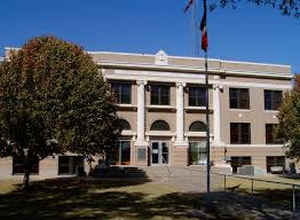
Education


Click Image to Enlarge
