


Click Image to Enlarge
Texas Counties
Texas is divided into two hundred and fifty-four counties, more than any other state. Texas was originally divided into municipalities, a unit of local government under Spanish and Mexican rule. When the Republic of Texas gained its independence in 1836, there were 23 municipalities, which became the original Texas counties. Many of these would later be divided into new counties. The most recent county to be created was Kenedy County in 1921. The most recent county to be organized was Loving County in 1931Somervell County, Texas
Somervell County Education, Geography, and History
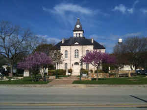
Somervell County is a county located on the Edwards Plateau in the state of Texas. Based on the 2010 census, its population was 8,490. Its
county seat is Glen Rose. The county is named for Alexander Somervell, Secretary of War for the Republic of Texas.
Somervell County is included in the Dallas-Fort Worth-Arlington, TX Metropolitan Statistical Area and the Granbury Micropolitan Area.
Etymology - Origin of Somervell County Name
Alexander Somervell, a soldier in the Texas Revolution and leader of the Somervell Expedition, a military strike into Mexico that failed during the days of the Republic of Texas
Demographics:
County QuickFacts: CensusBureau Quick Facts
Somervell County History
Caddo tribe Anadarko villages were scattered along Trinity and Brazos Rivers. The Caddo tribe of Wichita also
inhabited the area. The Anadarko became entangled with the French battles with the Spanish and later the Anglos and suffered the consequences,
including diseases for which they had no immunity. By 1860, these tribes moved to Oklahoma.
The Tonkawa were hunter-gatherers of the area, and often traded with their allies the Caddo and Karankawa. Like the Wichita, Karankawa and
Jumano, the Tonkawa tattooed their bodies and faces. Friendly with the white settlers, Tonkawa were employed as scouts for the Texas Rangers
and United States Army. As they were pushed out by the Comanche, they moved to the Brazos Indian Reservation, and later to Oklahoma
Comanche bands continued depredations on settlers until their removal to Oklahoma after 1875.
The county was formed and organized in 1875 from Hood County. The town of Glen Rose became the county seat. The county is named for Alexander
Somervell, Secretary of War for the Republic of Texas.
Handbook of Texas Online
More than 100 million years ago dinosaurs roamed the area that is now Somervell County. The Paluxy River has some
of the best-preserved tracks found in the continental United States. Much of the excavation on these tracks was done
by Roland T. Bird of the American Museum of Natural History in New York. That museum, the University of Texas, the
Smithsonian Institution, and several local museums retain samples. Local efforts to protect and preserve tracks
imbedded along the river resulted in the foundation of Dinosaur Valley State Park,
a 1,523-acre facility formally dedicated in 1970. Prior to European settlement of North America, the area was
inhabited by American Indians, particularly members of the Caddo groups and Tonkawas. The southern edge of the
Wichita Confederacy of Caddos extended into this area, although the Tonkawas were the major tribal group. Apaches
and Comanches came into the area periodically. The first permanent Anglo settler was Charles E. Barnard,
who established an Indian trading post in the late 1840s with his brother, George Barnard,
for whom George's Creek was named. Charles's wife, Juana Cavasos Barnard, was
the granddaughter of Don Narciso Cavasos, recipient of the largest Spanish land grant in Texas. She had been
captured by Comanches in South Texas and ransomed by the Barnards. Barnard's Mill, built in 1860, was the first
building at the site that is now Glen Rose. The mill is still standing and is listed on the National Register of
Historic Places. During most of the 1850s and early 1860s the Barnard's Mill settlement was a part of Johnson
County. In 1866 the area was included in a new county, Hood, marked off entirely from Johnson County. Somervell
County was established in 1875, when residents in southern Hood and northern Bosque counties petitioned for a new
county because of their separation from markets and seats of government. The county, taken completely from Hood
County, was named for Alexander Somervell, who led an expedition to Mexico under
the Republic of Texas. The first and only county seat is Glen Rose, named in
1872. Other early communities included Wilcox, Rainbow, Nemo, and Glass. The census of 1880 indicated a population
of 2,649, with only 132 in Glen Rose. At that time Somervell County had a black population of twenty-four. More at
Richard Elam, "SOMERVELL COUNTY," Handbook of Texas Online (http://www.tshaonline.org/handbook/online/articles/hcs12),
accessed January 24, 2016. Uploaded on June 15, 2010. Published by the Texas State Historical Association.
Geography: Land and Water
As reported by the Census Bureau, the county has a total area of 192 square miles (497 km2), of which, 187
square miles (485 km2) of it is land and 5 square miles (12 km2) of it (2.46%) is water. It is the third-smallest
county in Texas.
Neighboring Counties
Bordering counties are as follows:
- Hood County (north)
- Johnson County (east)
- Bosque County (south)
- Erath County (west)
Education


Click Image to Enlarge
