


Click Image to Enlarge
Texas Counties
Texas is divided into two hundred and fifty-four counties, more than any other state. Texas was originally divided into municipalities, a unit of local government under Spanish and Mexican rule. When the Republic of Texas gained its independence in 1836, there were 23 municipalities, which became the original Texas counties. Many of these would later be divided into new counties. The most recent county to be created was Kenedy County in 1921. The most recent county to be organized was Loving County in 1931Taylor County, Texas
Taylor County Education, Geography, and History
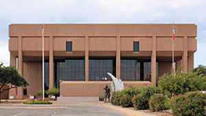
Taylor County is a county located in the state of Texas. Based on the 2010 census, its population was 131,506. Its county seat is Abilene.
The county was created in 1858 and later organized in 1878. It is named for Edward Taylor, George Taylor, and James Taylor, three brothers who
died at the Battle of the Alamo.
Taylor County is included in the Abilene, TX Metropolitan Statistical Area, and is considered part of West Texas.
Etymology - Origin of Taylor County Name
Edward Taylor, George Taylor, and James Taylor, three brothers who died at the Alamo
Demographics:
County QuickFacts: CensusBureau Quick Facts
Taylor County History
Taylor County is a county located in the US state of Texas. Is county seat is Abilene, Texas. Taylor is named for Edward Taylor, George Taylor, and James Taylor, three brothers who died at the Battle of the Alamo.
Handbook of Texas Online
Comanches of the Penateka band led the advance into the region in the eighteenth century. In 1858 the Texas
legislature established Taylor County, named for Alamo defenders Edward, James, and George Taylor,
from lands formerly assigned to Bexar and Travis counties. Taylor County was attached to Travis and Bexar counties
for judicial and administrative purposes until 1873, when these responsibilities were assigned to Eastland County.
Partly due to the presence of Indians, the area remained largely unsettled. The Penatekas maintained their
independence until the 1870s, when, after much bloodshed, they were defeated by the United States Army. The earliest
group of European settlers in Taylor County were buffalo hunters and bone
gatherers, who arrived during the 1870s. Sam Gholson, William C. Dunn, and William E. Cureton were among the early
settlers. As more people moved into the area, the county was organized in 1878, and Buffalo Gap, a small settlement
near the center of the county, became the seat of government. By 1880 there were 917 people living in the area, and
ranching completely dominated the local economy. The agricultural census for that year counted 107 farms and
ranches, encompassing 30,213 acres, but only 3,099 acres were described as "improved." Over 30,000 cattle and almost
6,000 sheep were reported, but only 157 acres were planted in wheat, the county's most important crop at that time;
another 73 acres were planted in corn. Settlement accelerated when the Texas and Pacific Railway built through the
area in the early 1880s. Buffalo Gap was bypassed by the railroad, which was routed instead to pass through the
northern part of the county to the site of a new town, to be called Abilene. In 1881 the railroad connected the area
to national markets and encouraged immigration. While Abilene began to develop into a shipping center, Buffalo Gap
declined in population, and, after an election held in 1883, Abilene became the county seat. Attempts by the people
of Buffalo Gap to challenge the election results by force of arms were quickly suppressed. More at
John Leffler, "TAYLOR COUNTY," Handbook of Texas Online (http://www.tshaonline.org/handbook/online/articles/hct02),
accessed January 24, 2016. Uploaded on June 15, 2010. Published by the Texas State Historical Association.
Geography: Land and Water
As reported by the Census Bureau, the county has a total area of 919 square miles (2,381 km2), of which, 916
square miles (2,371 km2) of it is land and 4 square miles (9 km2) of it (0.39%) is water.
Neighboring Counties
Bordering counties are as follows:
- Jones County (north)
- Callahan County (east)
- Coleman County (southeast)
- Runnels County (south)
- Nolan County (west)
Education


Click Image to Enlarge
