


Click Image to Enlarge
Texas Counties
Texas is divided into two hundred and fifty-four counties, more than any other state. Texas was originally divided into municipalities, a unit of local government under Spanish and Mexican rule. When the Republic of Texas gained its independence in 1836, there were 23 municipalities, which became the original Texas counties. Many of these would later be divided into new counties. The most recent county to be created was Kenedy County in 1921. The most recent county to be organized was Loving County in 1931Terrell County, Texas
Terrell County Education, Geography, and History
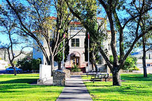
Terrell County is a county located in the state of Texas. Based on the 2010 census, its population was 984, making it the eighth-least
populous county in Texas. Its county seat is Sanderson. The county was named for Alexander W. Terrell, a Texas state senator.
Terrell County is one of the nine counties that comprise the Trans-Pecos region of West Texas.
Etymology - Origin of Terrell County Name
Alexander Watkins Terrell, attorney, judge, state legislator, diplomat, and Confederate cavalry officer
Demographics:
County QuickFacts: CensusBureau Quick Facts
Terrell County History
Evidence of the indigenous peoples of Terrell County are found on the county's various ranches - arrowheads, tools,
burned-rock middens, caves, and shelters containing Indian pictographs. Pieces of reed sandals, baskets, and evidence of burials have been
found in the caves. The most pictographs are on cliff walls above Myers Spring near Dryden, overpainting giving to the theory that several
Indian cultures were involved.
Capt. Jose de Berroterán in 1729 commanded an expedition on behalf of Spain to explore from Mission San Juan Bautista up the Rio Grande to the
mouth of the Rio Conchos. Berroterán crossed the southern border, where at a spring near Dryden, legend has it that he placed a large wooden
cross. Six years later, another Spaniard, Blas María de la Garza Falcón, found the cross while conducting an expedition in the area and named
the spot Santa Cruz de Maya. Captain Samuel Highsmith, under the command of John Coffee Hays, crossed the county in 1848 in an ill-fated
expedition to open a road from San Antonio to El Paso. In 1851 Army officer and geographer Lt. Nathaniel Michler, working under Major William
H. Emory, mapped this portion of the boundary between Mexico and the United States. Under Lt. William Echols in 1859, caravans of the US
Camel Corps crossed the county searching for a shorter route to Fort Davis.
In 1905, Terrell County was created by the Texas Legislature by carving about 1,500,000 acres (6,100 km2) out of Pecos County. It was
organized the same year. The county was named for
Alexander W. Terrell, a Texas state senator. Sanderson became the county seat. In 1881, Texas and New Orleans Railroad surveyors reached the site of
present-day Sanderson. Originally named Strawbridge by founder Cyrus W. 'Charley' Wilson, the name was later changed in honor of railroad
Engineer Joseph P. Sanderson. Charles Downie, a Scot, homesteaded in 1881 and became the first permanent sheepman in the area.
Handbook of Texas Online
Terrell County was formed by an act of the Texas legislature on April 8, 1905, and organized on July 27 of that
year. Sanderson became the county seat. Cattle and sheep ranching have dominated the county's economy since its
beginnings. In 1910 the United States census reported sixty ranches, encompassing 621,000 acres, in the county. More
than 111,000 sheep, almost 19,000 goats, and about 20,000 cattle were reported in the county that year, but only 800
acres was classified as "improved." In 1930 the county had 141 ranches, encompassing almost 1,450,000 acres, and
more than 351,000 sheep and about 10,000 cattle were reported; only 43 acres of cropland was harvested in the county
that year. Terrell County's population rose gradually from 1,430 in 1910 to 2,680 by 1920 and to 2,952 by 1930. The
number of ranches in the area dropped slightly during the Great Depression of
the 1930s; 136 remained in 1940. The population rose slightly during the depression to reach 2,952 by 1940. A number
of stations-Emerson, Gavilan, Feodora, Shaw, Thurston, Watkins, Malvado, Lozier-were built along the Southern
Pacific Railroad between 1946 and the 1960s. Each station, or "section," had a foreman and a crew of laborers who
were responsible for maintenance and repairs over about ten miles of track. The foreman and the laborers lived with
their families in railroad-owned houses at the section. By the 1980s almost all had been eliminated by the railroad
company: the buildings were gone, and the remaining laborers had become "floating" crews who traveled up and down
US 90 beside the tracks to wherever their services were needed More at
Walter G. Downie, "TERRELL COUNTY," Handbook of Texas Online (http://www.tshaonline.org/handbook/online/articles/hct03),
accessed January 24, 2016. Uploaded on June 15, 2010. Modified on July 25, 2015. Published by the Texas State Historical Association.
Geography: Land and Water
As reported by the Census Bureau, the county has a total area of 2,358 square miles (6,107 km2), virtually all
of which is land.
Neighboring Counties
Bordering counties are as follows:
- Pecos County (north & west)
- Crockett County (northeast)
- Val Verde County (east)
- Brewster County (southwest)
- Acu?, Coahuila, Mexico (south)
Education


Click Image to Enlarge
