


Click Image to Enlarge
Texas Counties
Texas is divided into two hundred and fifty-four counties, more than any other state. Texas was originally divided into municipalities, a unit of local government under Spanish and Mexican rule. When the Republic of Texas gained its independence in 1836, there were 23 municipalities, which became the original Texas counties. Many of these would later be divided into new counties. The most recent county to be created was Kenedy County in 1921. The most recent county to be organized was Loving County in 1931Tyler County, Texas
Tyler County Education, Geography, and History
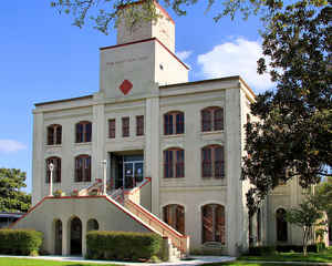
Tyler County is a county located in the state of Texas. Based on the 2010 census, its population was 21,766. Its seat is Woodville. Tyler County is named for John Tyler, the tenth President of the United States.
Etymology - Origin of Tyler County Name
John Tyler, the tenth president of the United States
Demographics:
County QuickFacts: CensusBureau Quick Facts
Tyler County History
Tyler County is a county located in the US state of Texas. Its seat is Woodville. Tyler County is named for John
Tyler, the tenth President of the United States.
Despite its name, Tyler County does not contain the city of Tyler, Texas; the latter is located approximately 140 miles
to the north in Smith County.
Handbook of Texas Online
The area of Tyler County was for centuries occupied by agricultural Caddoan, and possibly Atakapan, Indians. White
settlers there in the early nineteenth century encountered both Caddoan-related Cherokees uprooted from the east and
groups of Alabama and Coushatta Indians, recent migrants from Louisiana. In 1809 there were hundreds of Alabama
Indians living on the west bank of the Neches River, three leagues above the junction of the Neches and Angelina
rivers. At Peach Tree Village in Tyler County, their principal Texas settlement,
the Alabamas kept cattle, horses, and hogs and cultivated corn, potatoes, beans, and yams. The Cherokees were
eventually driven from the state by order of Mirabeau B. Lamar, but the Alabamas
and Coushattas cooperated with Sam Houston and others friendly to their cause
and have survived as one of only two Indian groups living on their own reservations in Texas. The Alabama-Coushatta
Reservation is just across the western Tyler County line in Polk County. The settlement by whites of what was to
become Tyler County began before the time of the Texas Revolution in 1836. Three
Americans received land grants there from Mexican authorities in 1834, and thirty-four more men and one woman, Jane
Taylor, received grants during 1835. The area was originally organized in 1842 under the name of Menard District,
"for judicial and other purposes," from a part of Liberty County. Tyler County was officially established by the
Texas legislature on April 3, 1846, and was named in honor of President John Tyler. In 1842 Town Bluff, one of two
early settlements, became the temporary county seat. In 1845 a permanent location was chosen. This was the site of
the present county seat, Woodville, on 200 acres of land donated by Dr. Josiah Wheat in the forks of Turkey Creek.
Woodville was named in honor of George T. Wood, who introduced the bill to
establish the county and was the second governor of the state of Texas. The other early settlement, Fort Teran, on
the Neches River where it crossed the Old Spanish Trail from Nacogdoches to
Liberty, was established as a result of Anastasio Bustamante's Law of April 6,
1830 and its policies of restrictions on immigration. More at
Megan Biesele, "TYLER COUNTY," Handbook of Texas Online (http://www.tshaonline.org/handbook/online/articles/hct10),
accessed January 24, 2016. Uploaded on June 15, 2010. Published by the Texas State Historical Association
Geography: Land and Water
As reported by the Census Bureau, the county has a total area of 936 square miles (2,423 km2), of which, 923
square miles (2,390 km2) of it is land and 13 square miles (33 km2) of it (1.37%) is water.
Neighboring Counties
Bordering counties are as follows:
- Angelina County (north)
- Jasper County (east)
- Hardin County (south)
- Polk County (west)
Education


Click Image to Enlarge
