


Click Image to Enlarge
Texas Counties
Texas is divided into two hundred and fifty-four counties, more than any other state. Texas was originally divided into municipalities, a unit of local government under Spanish and Mexican rule. When the Republic of Texas gained its independence in 1836, there were 23 municipalities, which became the original Texas counties. Many of these would later be divided into new counties. The most recent county to be created was Kenedy County in 1921. The most recent county to be organized was Loving County in 1931Van Zandt County, Texas
Van Zandt County Education, Geography, and History
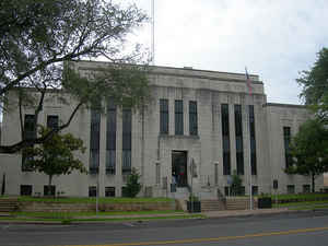
Van Zandt County is a county located in the state of Texas, in the northeastern part of the state. Based on the 2010 census, its population was 52,579. Its county seat is Canton. The county is named for Isaac Van Zandt, a member of the Congress of the Republic of Texas
Etymology - Origin of Van Zandt County Name
Isaac Van Zandt, early Texas settler, attorney, Texas legislator, and diplomat, considered by many to be the founder of Marshall, Texas
Demographics:
County QuickFacts: CensusBureau Quick Facts
Van Zandt County History
Van Zandt County is a county located in the US state of Texas.Its county seat is Canton. The county is named for Isaac Van Zandt, a member of the Congress of the Republic of Texas.
Handbook of Texas Online
Van Zandt County was established by the legislature in 1848 from part of Henderson County and named for Republic
of Texas leader Isaac Van Zandt. Sabine Lake (Jordan's Saline) was named the
county seat, a crude log courthouse was built, and court was held for the first time in December 1848. In 1850 Wood
County was carved out of Van Zandt County, and the Van Zandt county seat was moved to Canton. The 1850 census
indicated that the recently established county had 1,348 residents. The overwhelming majority of the residents (92
percent) came from the states of the Old South, with the largest number from Tennessee and Alabama. In addition,
there were a small number of recent immigrants from Europe, including a Norwegian colony settled by Johan Reierson
at Four Mile Prairie in the southwestern portion of the county. In its early years the economy was largely
subsistence farming, though some settlers also engaged in the salt trade. The salt in the area had been known to the
Indians, who extracted it in the northeastern part of the county near the site of present Grand Saline. Jordan had a
salt extraction operation at Jordan's Saline in 1845. Plantation farming did not prove profitable, and slave
population dropped to 322 in a total population of 6,494 in 1860. A cotton gin, built at Hamburg by Burrel H.
Hambrick in 1853, was moved to Tyler prior to the Civil War. Despite the small
number of slaves, a majority of Van Zandt's citizens (181 of 308) voted for secession
in 1861, and local men volunteered for service in the Confederate army in sizeable numbers. Many enlisted in the
Tenth Texas Cavalry under Col. M. F. Lock, while others joined the Sixth Texas Cavalry, the Third Texas Cavalry,
the Fifteenth Texas Cavalry, and the Eleventh Texas Infantry. Not all of the citizens, however, supported the
Southern cause. Many of the Norwegian settlers, who were opposed to slavery on moral grounds, and a number of small
farmers, who resented the power and influence of the state's large plantation owners, spoke out against the war. In
1864 three of the Unionists were lynched, and some of the Norwegian settlers were arrested, effectively quelling the
opposition. The anti-slavery stance of this vocal minority, however, reportedly gave rise to the practice of calling
the county the "Free State of Van Zandt." According to one story, the name arose when Sidney S. Johnson
of the Canton Times wrote that one slave driver seeking a site in Texas to bring his slaves to safety said
that he would rather settle in a free state than bring his slaves to Van Zandt because of its Unionist reputation More at
Gerald F. Kozlowski, "VAN ZANDT COUNTY," Handbook of Texas Online (http://www.tshaonline.org/handbook/online/articles/hcv02),
accessed January 24, 2016. Uploaded on June 15, 2010. Published by the Texas State Historical Association.
Geography: Land and Water
As reported by the Census Bureau, the county has a total area of 859 square miles (2,226 km2), of which, 849
square miles (2,198 km2) of it is land and 10 square miles (28 km2) of it (1.26%) is water.
Neighboring Counties
Bordering counties are as follows:
- Rains County (north)
- Wood County (northeast)
- Smith County (east)
- Henderson County (south)
- Kaufman County (west)
- Hunt County (northwest)
Education


Click Image to Enlarge
