


Click Image to Enlarge
Texas Counties
Texas is divided into two hundred and fifty-four counties, more than any other state. Texas was originally divided into municipalities, a unit of local government under Spanish and Mexican rule. When the Republic of Texas gained its independence in 1836, there were 23 municipalities, which became the original Texas counties. Many of these would later be divided into new counties. The most recent county to be created was Kenedy County in 1921. The most recent county to be organized was Loving County in 1931Ward County, Texas
Ward County Education, Geography, and History
Ward County is a county located in the state of Texas. Based on the 2010 census, the population was 10,658. The county seat is Monahans. The county was created in 1887 and organized in 1892. It is named for Thomas W. Ward, a soldier in the Texas Revolution.
Etymology - Origin of Ward County Name
Thomas W. Ward, a commissioner for the General Land Office of Texas and mayor of Austin, Texas
Demographics:
County QuickFacts: CensusBureau Quick Facts
Ward County History
Archeological investigations conducted in northwestern Ward County have found evidence of prehistoric man in the form
of occupational debris, petroglyphs, and pictographs. Tribes occupying the area include Suma-Jumano, Apache and Comanche. The sand hills have
contained native artifacts.
The Butterfield Overland Mail in 1858 used Emigrant's Crossing, where exposed rocks afford one of the few places safe for fording the Pecos
River. The stage line had an adobe station and a high-walled adobe corral there.
In 1881 the Texas and Pacific Railway crossed the region and established stations at Sand Hills, Monahans, Aroya, Pyote, Quito, Quito Quarry,
and Barstow.
The Texas state legislature carved Ward County from a portion of Tom Green County in 1887. The county was organized in 1892. Barstow became
the county seat. The county seat is now Monahans, and the county is named for
Thomas W. Ward, a soldier in the Texas Revolution.
Handbook of Texas Online
Archeological investigations conducted in northwestern Ward County have found evidence of prehistoric man in the
form of occupational debris, petroglyphs, and pictographs. Historic Indian groups that may have successively
occupied or annually traveled through what is now Ward County include the Jumanos, the Apaches, and the Comanches.
Information concerning these Indians can be found in journals written by early Spanish explorers, including Ãlvar
Nðñez Cabeza de Vaca and Antonio de Espejo. Although Cabeza de Vaca did not
describe any particular Indians in or around the area that is now Ward County, he did mention "the cow nation" that
may have ranged over the area. These bison hunters were probably the same group that Espejo, leader of a Spanish
expedition through West Texas in 1583, called the Jumanos. The sand dunes east of the site of present Monahans are
claimed to have been an annual watering spot for Comanches. Water is available at shallow depths in the sand hills,
a critical factor in attracting human populations to the area. Large numbers of artifacts, including projectile
points, beads, and scrapers, and various other stone tools have been found in the sand hills. The Emigrant Road,
routed on a survey conducted in 1849 by Randolph B. Marcy, passed from Dona Ana
to Preston and skirted the southern part of what is now Ward County. The Butterfield Overland Mail
used Emigrant's Crossing of the Pecos River. In 1881 the Texas and Pacific Railway crossed the region and
established stations at Sand Hills, Monahans, Aroya, Pyote, Quito, Quito Quarry, and Barstow. The Texas state
legislature carved Ward County from a portion of Tom Green County in 1887, but by 1890 only seventy-five people
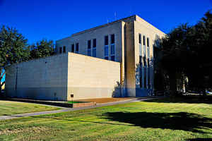
lived there. The county was organized in 1892, and Barstow became the county seat; a red sandstone courthouse was
built in 1893. By 1900 the United States Agricultural Census found 167 farms and ranches, encompassing 424,000
acres, in the area, but only 5,500 acres were described as "improved." The economy revolved primarily around
ranching at that time. Almost 13,000 cattle and about 4,400 sheep were reported
in the county that year, while only eighty-three acres were planted in corn and 1,500 acres in cotton. The census
reported 1,451 people that year. By 1904 Barstow had become a farming and ranching trade center located near
numerous vineyards and orchards made possible by irrigation projects on the Pecos River. In 1904, however, an
earthen dam on the Pecos burst, and the resulting flood waters salted and ruined many of the farms near Barstow. A
serious drought plagued farmers in 1907; nevertheless, by 1910 there were 231 farms and ranches, and 2,389 people
lived there. Almost 14,000 cattle were reported that year, and 3,000 acres were planted in cotton. There was another
drought in 1910, and the vineyards and orchards began to decline by 1911; farming along the Pecos had ceased by
1918. Cotton production expanded in the county during the 1910s, however, and by 1920 more than 10,000 acres were
devoted to the fiber. That year there were 238 farms and ranches, and the population had increased slightly to reach
2,615. More at
Glenn Justice and John Leffler, "WARD COUNTY," Handbook of Texas Online (http://www.tshaonline.org/handbook/online/articles/hcw03),
accessed January 24, 2016. Uploaded on June 15, 2010. Published by the Texas State Historical Association.
Geography: Land and Water
As reported by the Census Bureau, the county has a total area of 836 square miles (2,165 km2), of which, 835
square miles (2,164 km2) of it is land and 1 square miles (1 km2) of it (0.03%) is water.
Neighboring Counties
Bordering counties are as follows:
- Winkler County (north)
- Ector County (northeast)
- Crane County (east)
- Pecos County (south)
- Reeves County (west)
- Loving County (northwest)
Education


Click Image to Enlarge
