


Click Image to Enlarge
Texas Counties
Texas is divided into two hundred and fifty-four counties, more than any other state. Texas was originally divided into municipalities, a unit of local government under Spanish and Mexican rule. When the Republic of Texas gained its independence in 1836, there were 23 municipalities, which became the original Texas counties. Many of these would later be divided into new counties. The most recent county to be created was Kenedy County in 1921. The most recent county to be organized was Loving County in 1931Wharton County, Texas
Wharton County Education, Geography, and History
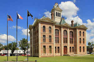
Wharton County is a county located in the state of Texas. Based on the 2010 census, its population was 41,280. Its county seat is Wharton.
The county was named for brothers William Harris Wharton and John Austin Wharton.
The El Campo, TX Micropolitan Statistical Area includes all of Wharton County.
Etymology - Origin of Wharton County Name
William Harris Wharton and John Austin Wharton, father and son and leaders in revolutionary Texas
Demographics:
County QuickFacts: CensusBureau Quick Facts
Wharton County History
Wharton County is a county located in the US state of Texas. Its county seat is Wharton
Handbook of Texas Online
Dispersed settlement in the county continued through the Republic of Texas period from 1836 to 1846. Aside from
occasional farm settlements, the area was a near wilderness. After the war postal stations were established at Egypt
and Peach Creek in 1836, Preston in 1839, Wharton in 1846, and Waterville in 1859. Wharton County was established
after Texas statehood and the Mexican War in 1846 from parts of Matagorda,
Jackson, and Colorado counties, taking their best and most fertile land. The act that formed the county provided for
its immediate organization and a county seat to be named Wharton and located on the northeast bank of the Colorado
River in the east central portion of the county within one of the leagues granted to William Kincheloe.
Colonists brought their religion with them and practiced it, even though Mexican law forbade any organized religion
in Texas other than Catholic. Kincheloe was one of eleven Baptist heads of households in Austin's colony, and his
home on the east bank of Peach Creek is reputed to be the site of the colony's first Protestant service, conducted
by Joseph Bays in 1822. The Kincheloe estate was also the site of the second or
third Baptist Sunday school in Texas; Bays organized it in late 1829 or early 1830. It is probable that families of
all denominations attended the services. According to tradition, Reverend Noah Hill helped organize the first
Baptist Church in Wharton on May 23, 1847, with twenty-four whites and ninety-eight slaves as charter members. A. C.
Horton was a charter trustee for Baylor University in 1845 and donated a bell to the Ladies Seminary in Independence
in 1858. In 1835 Reverend J. W. Kinney held a Methodist camp meeting in Egypt at W. J. E. Heard's home, and it is
purported to be the first such denominational service held west of the Trinity River; white and black families were
in attendance. Methodist circuit riders who served Egypt and other areas that would become Wharton County were Homer
S. Thrall, Martin Ruter, and John Wesley DeVilbiss. Ruter made his headquarters
at Captain Heard's in Egypt, and when Rutersville College was established after Ruters death, Heard was among its
supporters. J. W. DeVilbiss was assigned to the Egypt area circuit and married Talitha Menefee, daughter of William
Menefee, signer of the Texas Declaration of Independence
and a resident of Egypt More at
Merle R. Hudgins, "WHARTON COUNTY," Handbook of Texas Online (http://www.tshaonline.org/handbook/online/articles/hcw06),
accessed January 24, 2016. Uploaded on June 15, 2010. Published by the Texas State Historical Association.
Geography: Land and Water
As reported by the Census Bureau, the county has a total area of 1,094 square miles (2,835 km2), of which,
1,090 square miles (2,823 km2) of it is land and 4 square miles (12 km2) of it (0.39%) is water.
Neighboring Counties
Bordering counties are as follows:
- Austin County (north)
- Fort Bend County (northeast)
- Brazoria County (east)
- Matagorda County (southeast)
- Jackson County (southwest)
- Colorado County (northwest)
Education


Click Image to Enlarge
