


Click Image to Enlarge
Utah Counties
There are twenty-nine counties in the State of Utah. There were originally seven counties established under the provisional State of Deseret in 1849: Davis, Iron, Sanpete, Salt Lake, Tooele, Utah, and Weber. The Territory of Utah was created in 1851 with the first territorial legislature meeting from 1851-1852. The first legislature re-created the original counties from the State of Deseret under territorial law as well as establishing three additional counties: Juab, Millard, and Washington. All other counties were established between 1854 and 1894 by the Utah Territorial Legislature under territorial law except for the last two counties formed, Daggett and Duchesne.Utah County, Utah
Utah County Education, Geography, and History
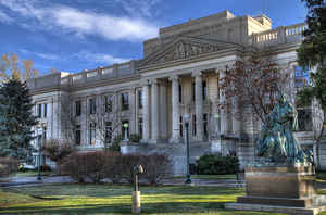
Utah County is a county in the state of Utah. Based on the 2010 census, the population was 516,564, making it the second-most populous
county in Utah. The county seat and largest city is Provo, which is the third-largest city in the state. The county was created in 1850 and
named for the Spanish name (Yuta) for the Ute Indians.
Utah County is part of the Provo-Orem, UT Metropolitan Statistical Area as well as the Salt Lake City-Provo-Orem, UT Combined Statistical
Area.
Etymology - Origin of Utah County Name
Named for the Spanish name (Yuta) for the Ute Indians.
Demographics:
County QuickFacts: CensusBureau Quick Facts
Utah County History
The most striking geographical
features of Utah County are the Wasatch Mountains along the eastern boundary and
Utah Lake, the state's largest freshwater lake, to the west. The high mountains,
rising over 11,000 feet, receive heavy snowfall which feeds the numerous rivers
and creeks that flow into the lake. Though large in size, Utah Lake is very
shallow 18 feet at its deepest point.
Before the valley was settled by Mormon pioneers in the 1840s and 50s, it was
the home of the Ute Indians. They lived along the eastern shore of the lake and
along the Jordan River and used fish as their main food. They were described as
peaceful and kind by the Franciscan priests Dominguez and Escalante, who
observed them in the summer of 1776. When the Dominguez-Escalante party came
down Spanish Fork Canyon, they became the first non-Indians to enter Utah
Valley.
Mormon pioneers began settling Utah Valley in 1849. Like the Indians before
them, they chose to settle on the fertile, well-watered strip of land between
the mountains and Utah Lake. Eventually, over a dozen towns were established
between Lehi on the north and Santaquin on the south. Provo, named for the fur
trapper Etienne Provost, has always been the largest town and the county seat.
Farming was the most important early activity in the county, with fruit growing
and the processing of sugar beets being especially important. In recent years
the center of the fruit industry in the county has shifted from Orem to the
south end of the valley, where orchards are not threatened by housing
developments.
Utah County holds an important place in the state's industrial history. The
Provo Woolen Mill, which sold its first cloth in 1873, was the first large
manufacturing plant in Utah. The first large-scale sugar beet factory in Utah
was built in Lehi in 1890. The Olmstead power plant and the Telluride Institute
at the mouth of Provo Canyon made many technological advances in electric power
transmission in the late 19th and early 20th centuries. Mining was also an
important industry in Utah County. In the late 1800s and early 1900s there were
many successful mines in American Fork Canyon and in the Tintic Mining District
centered near Eureka, Juab County, and including part of western Utah County.
Many of the fine homes and business buildings in Provo were constructed with
mining money.
Today, Utah County is best known as the home of the Geneva steel plant and
Brigham Young University. Geneva was constructed at this inland location during
World War II in case the steel plants near the coast were destroyed in the war.
BYU was established in 1875 as a small high-school level "academy," but it has
grown to become a major university with 27,000 students. Both Geneva and BYU
have contributed greatly to making the county what it is today.
*Source: Beehive History 14: Utah Counties. 1988. Utah State Historical Society, 300 Rio Grande, Salt Lake City, UT 84101-1182.
Geography: Land and Water
As reported by the Census Bureau, the county has a total area of 2,141 square miles (5,545 km2), of which,
1,998 square miles (5,176 km2) of it is land and 143 square miles (369 km2) of it (6.66%) is water.
Utah Valley lies at the center of the county, lined by the mountains of the Wasatch Front on the east. Utah Lake
occupies a large part of the valley. The elevation ranges from 4,487 at the lake to 11,928 at the peak of Mount
Nebo.
Neighboring Counties
Bordering counties are as follows:
- Salt Lake County, Utah - (north)
- Tooele County, Utah - (west)
- Wasatch County, Utah - (east)
- Juab County, Utah - (south and west)
- Sanpete County, Utah - (south central)
- Carbon County, Utah - (south on east)
- Duchesne County, Utah - (southeast)
Education
Utah County has three school districts. They are Alpine, Provo, and Nebo.
It also has two universities: Brigham Young University and Utah Valley University. The county also has the
Mountainland_Applied_Technology_College.


Click Image to Enlarge
