

Click Image to Enlarge
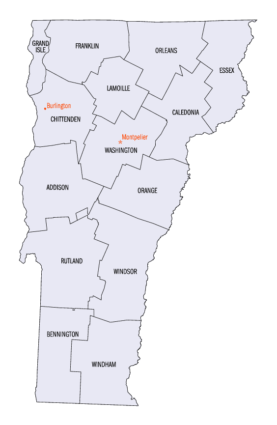
Vermont Counties
There are fourteen counties in Vermont. Each county has a county seat, known in Vermont as shire town. In 1777, Vermont had two counties. The western side of the state was called Bennington County and the eastern was called Cumberland County. In 1781 Cumberland County was broken up into three counties in Vermont, plus Washington County, which eventually became part of New Hampshire. Today's Washington County was known as Jefferson County until 1814. Essex County, Orleans County, and Caledonia County are commonly referred to as the Northeast Kingdom.Caledonia County, Vermont
Caledonia County Education, Geography, and History
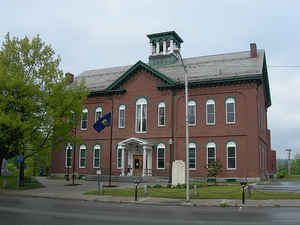
Caledonia County is a county located in the state of Vermont. Based on the 2010 census, the population was 31,227. Its shire town is St. Johnsbury. The county was created in 1792 and organized in 1796. It was given the Latin name for Scotland, in honor of the many settlers who claimed ancestry there.
Etymology - Origin of Caledonia County Name
The county was called "Caledonia" -the ancient Roman name of Scotland, out of regard for the emigrants from that country who had purchased large tracts of land in the county, and had large and flourishing settlements in Barnet and Ryegate
Demographics:
County QuickFacts: CensusBureau Quick Facts
Caledonia County History
The county
shares the same pre-Columbian history with the Northeast Kingdom.
Rogers' Rangers were forced to retreat through the county following their attack on Saint-Francis, Quebec in 1759. To confound their avenging
pursuers, they had split up. One group came south over the summit into the Passumpsic River Valley.
Vermont was divided into two counties in March, 1778. In 1781 the legislature divided the northernmost county, Cumberland, into three
counties: Windham and Windsor, located about where they are now. The northern remainder was called Orange county. This latter tract nearly
corresponded with the old New York county of Gloucester, organized by that province March 16, 1770, with Newbury as the shire town.
On November 5, 1792, Caledonia County was incorporated from Orange County, including all that part of Vermont north
of that county, and extending so far west as to include Montpelier and adjacent towns, however, the Caledonia County was
not fully organized until November 8, 1796, when Danville was made the shire town. In 1811, the state of Vermont was
divided into eleven counties and the counties of Orleans and Essex were incorporated from Caledonia County. In addition,
in 1811, four towns from Caledonia County were incorporated into Washington County, to which Woodbury was also annexed,
in 1836, and Cabot, in 1855. In 1856, the county seat was removed from Danville to St. Johnsbury where new county
buildings were erected.
Geography: Land and Water
As reported by the Census Bureau, the county has a total area of 658 square miles (1,703 km2), of which, 651
square miles (1,685 km2) of it is land and 7 square miles (18 km2) of it (1.06%) is water.
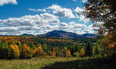
Caledonia is the most populated county of the three in the Northeast Kingdom. However, it is the smallest of the three.
The county has a number of brooks and rivers. The Connecticut River runs along the southeast and forms one of the
eastern boundaries of the county. The northern towns are drained by the head branches of the Passumpsic River, which is
the largest in the county. It flows south and empties into the Connecticut River in Barnet. There are the Wells, Stevens
and Joe's Rivers in the south. In the west the head waters of the Winooski and Lamoille Rivers. There are about twenty
lakes and ponds in the county. The largest are Harvey's Lake, in Barnet; Wells River and Lund's Ponds, in Groton; Cole's
Pond, in Walden; Clark's and Center Ponds, in Newark; and Stile's Pond, in Waterford. There are falls at different
places on the Connecticut, Passumpsic, Wells and Joe's Rivers. Stevens River, near its mouth, falls 80 feet (24 m) in a
distance of 20 rods (330 ft/100 m). Some of the water power has been harnessed for electricity.
There are sulphur springs in Wheelock, Haynesville, in Hardwick; and in St. Johnsbury, near the Moose River.
Neighboring Counties
Bordering counties are as follows:
- Orleans County, Vermont - north
- Essex County, Vermont - northeast
- Grafton County, New Hampshire - south
- Washington County, Vermont - southwest
- Orange County, Vermont - southwest
- Lamoille County, Vermont - west
Education


Click Image to Enlarge
