

Click Image to Enlarge
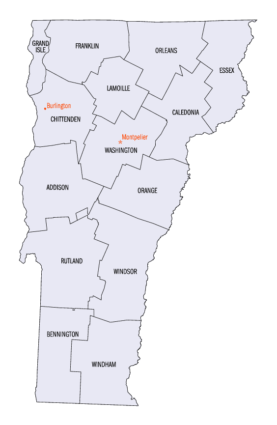
Vermont Counties
There are fourteen counties in Vermont. Each county has a county seat, known in Vermont as shire town. In 1777, Vermont had two counties. The western side of the state was called Bennington County and the eastern was called Cumberland County. In 1781 Cumberland County was broken up into three counties in Vermont, plus Washington County, which eventually became part of New Hampshire. Today's Washington County was known as Jefferson County until 1814. Essex County, Orleans County, and Caledonia County are commonly referred to as the Northeast Kingdom.Rutland County, Vermont
Rutland County Education, Geography, and History
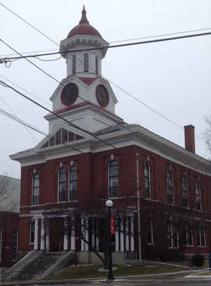
Rutland County is a county located in the state of Vermont. Based on the 2010 census, the population was 61,642, making it the second-most
populous county in Vermont. Its shire town (county seat) and most populous municipality is Rutland.It is named after the county of Rutland in
England.
Rutland County comprises the Rutland, VT Micropolitan Statistical Area.
Etymology - Origin of Rutland County Name
For Rutland, Massachusetts. The Town of Rutland is a residential hill town. Rutland's original lands of about 12 square miles were purchased from natives in Natick's Indian Praying Town in 1686.
Demographics:
County QuickFacts: CensusBureau Quick Facts
Rutland County History
The original Rutland was chartered in 1761 as part of the New Hampshire Grants by the Provincial Governor Benning Wentworth. The first settlers arrived in 1770 led by Colonel James Mead. Almost immediately a controversy arose with New York claiming the same land grants under the name of "Socialborough."This controversy ultimately led to the Vermonters forming the Republic of Vermont from 1777-1791. Vermont became the fourteenth state in 1791.
Timeline
On 16 February 1781 Rutland County was created from Bennington County. From 26 June 1781 until 23 February 1782, Vermont attempted to annex
part of New York east of the Hudson River (the so-called West Union); inhabitants in the area favored Vermont's township form of government,
while Vermont hoped to gain bargaining power through expansion. New York did not lose control of the area. For almost seven months Rutland
County included part of Charlotte County (now Washington County), New York.
In February 1783 Orange County gained the towns of Brookfield and Randolph and Windsor County gained the towns of Bethel and Rochester from
Rutland. On 18 October 1785 Addison County was created from Rutland.
On 27 February 1787 Windsor County gained the town of Stockbridge from Rutland, then on 31 October 1792 Rutland gained from Windsor County
when the town of Mount Holly was created from Jackson's Gore and the towns of Ludlow and Wallingford. Windsor County gained Benton's Gore from
Rutland on 2 March 1797.
On 25 October 1805 Rutland County gained from Bennington County when the town of Mount Tabor gained from the town of Peru. On 29 October 1806
Windsor County gained from Rutland County when the town of Rochester gained a small area from the town of Pittsfield. On 15 November 1813 the
county gained from Windsor County when the town of Pittsfield gained a small area from the town of Stockbridge, a change too small to appear
on maps. On 9 November 1814 Addison County gained from Rutland County when the town of Goshen gained from the town of Philadelphia. On 22
October 1822 the county gained from Windsor County when the town of Pittsfield gained a small area from the town of Stockbridge. On 3 November
1823 it gained from Windsor County again when the town of Shrewsbury gained a small area from the town of Plymouth. On 15 November 1824
Windsor County gained from Rutland County when the town of Rochester gained a small area from the town of Pittsfield.[20] On 17 November 1825
Bennington County gained from the county when the town of Dorset gained a small area from the town of Mount Tabor.
On 7 November 1839 the Legislature authorized Addison County to gain a small area from Rutland County when the town of Whiting was to gain
from the town of Orwell. But there is no evidence that a change took effect. Addison County gained the town of Orwell from Rutland County on 1
December 1847. On 6 March 1855 Addison County gained another small area from the county when the town of Goshen gained "Clemens Land" from the
town of Brandon.
On 10 November 1870 the Legislature authorized Rutland County to gain a small area from Windsor County when the town of Mount Holly was to
gain from the town of Weston. But there is no evidence that the change took effect. On 7 April 1880 the county lost to Washington County, New
York, when New York gained a small area west of the village of Fair Haven from Vermont due to a change in the course of the Poultney River, a
change too small to see on most maps. On 21 November 1884 Windsor County gained a small area from Rutland County when the town of Stockbridge
gained Parker's Gore. On 8 October 1895 Windsor County gained from the county when the town of Weston gained from the town of Mount Tabor.
Geography: Land and Water
As reported by the Census Bureau, the county has a total area of 945 square miles (2,447 km2), of which, 933
square miles (2,415 km2) of it is land and 12 square miles (32 km2) of it (1.30%) is water. The primary stream of
the county is Otter Creek, which runs through the county from the south to the north.
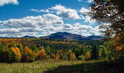
During the early 1800's the Rutland area was known for agriculture and for the sheep industry. By the mid 1800's the development of the marble industry and the arrival of the railroads created an industrial and retail boom which brought many immigrant workers to the Rutland area. Rutland has continued to grow in industry and population to become the largest city in Southern Vermont.
Neighboring Counties
Bordering counties are as follows:
- Addison County, Vermont - north
- Windsor County, Vermont - east
- Bennington County, Vermont - south
- Washington County, New York - west
Education


Click Image to Enlarge
