


Click Image to Enlarge
Washington Counties
There are thity-nine counties in the state of Washington. Washington was carved out of the western part of Washington Territory and admitted to the Union as the 42nd state in 1889. The first counties were created from unorganized territory in 1845.Chelan County, Washington
Chelan County Education, Geography, and History
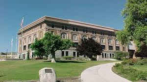
Chelan County is a county in the state of Washington. Based on the 2010 census, its population was 72,453. The county seat and largest city
is Wenatchee. The county was created out of Okanogan and Kittitas Counties on March 13, 1899. It derives its name from a Chelan Indian word
meaning "deep water," likely a reference to 55-mile (89 km)-long Lake Chelan, which reaches a maximum depth of 1,486 feet (453 m).
Chelan County is part of the Wenatchee, Washington, Metropolitan Statistical Area.
Etymology - Origin of Chelan County Name
A Native American word meaning deep water, probably a reference to Lake Chelan."Chelan" derives from a Chelan Indian word meaning "deep water,"
Demographics:
County QuickFacts: CensusBureau Quick Facts
Chelan County History
The county was created out of Okanogan and Kittitas Counties on March 13, 1899. It derives its name from a Chelan Indian word meaning "deep water"
Economic
Located in central Washington State, Chelan County is home to the Confluence Technology Center which through a partnership with Wenatchee Valley College, offers businesses customized workforce training, broadband connection, redundant power and a state-of-the-art videoconferencing center.
Wenatchee, the county seat and business hub, sits at the intersection of cross-state highways 2 and 97, and serves as an intersection of the state's fiber optic highway.
The regional hospital and clinic are recognized for quality health care services; and Pangborn Memorial Airport puts Sea-Tac just a 35 minute flight away.
Four distinct seasons and development of irrigation transformed Chelan County from a semi-arid landscape into one of
the most productive agricultural regions in the state. This region boasts the lowest power rates in the country -
generated by Columbia River hydroelectric dams.
Bounded by National Forest, the county attracts recreational enthusiasts and world-class adventurers from across the
state and around the world
Geography: Land and Water
As reported by the Census Bureau, the county has a total area of 2,994 square miles (7,753 km2), of which, 2,921 square miles (7,566 km2) of it is land and 72 square miles (187 km2) of it (2.41%) is water.
Chelan County embraces the drainages of the Wenatchee River, the Entiat River, and Lake Chelan, and the Chelan
River for a total of 2,920 square miles. Irrigation has transformed the arid valleys into agricultural treasure
houses and the home to Washington apples and the ubiquitous Aplet and Cotlet confections. Hydroelectric development
has lived up to the Wenatchee Daily World's claim as the "Power Belt of the State of Washington." Almost 90
percent of the county is owned by the state and federal governments.
Neighboring Counties
Bordering counties are as follows:
- Okanogan County, Washington northeast
- Douglas County, Washington east
- Kittitas County, Washington south
- King County, Washington southwest
- Snohomish County, Washington west
- Skagit County, Washington northwest
Education


Click Image to Enlarge
