


Click Image to Enlarge
Washington Counties
There are thity-nine counties in the state of Washington. Washington was carved out of the western part of Washington Territory and admitted to the Union as the 42nd state in 1889. The first counties were created from unorganized territory in 1845.Clallam County, Washington
Clallam County Education, Geography, and History
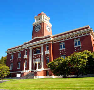
Clallam County is a county in the state of Washington. Based on the 2010 census, the population was 71,404. The county seat and largest city
is Port Angeles. The name is a Klallam word for "the strong people". The county was formed on April 26, 1854. Located on the Olympic
Peninsula, it is south from the Strait of Juan de Fuca, which forms the Canadian border, as British Columbia's Vancouver Island is across the
strait.
Clallam County comprises the Port Angeles, WA Micropolitan Statistical Area.
Etymology - Origin of Clallam County Name
A Klallam word meaning the strong people. Originally spelled Clalm. Named for the lands of the Klallam
(Makah and Quileute tribes.)
Demographics:
County QuickFacts: CensusBureau Quick Facts
Clallam County History
Clallam County was created 26 April 1854 from Jefferson County. County seat: Port Angeles
Clallam County occupies the northern portion of the Olympic Peninsula, extending nearly 100 miles along the Strait of Juan de Fuca on its north and more than 35 miles along the Pacific Coast on its west.
Economic
Clallam County is located on the North Olympic Peninsula of Washington State. The county's land area is 1,752 square miles with 200 miles of coastline. The county seat is Port Angeles. There are three incorporated communities: Port Angeles, Sequim and Forks.
Historically abundant in natural resource industries, Clallam County has identified six indigenous industries in
which assets and resources compliment growth. They are marine services, forest resources, agriculture, technology,
tourism, and education. An active and involved networking community supported by an enthusiastic EDC make Clallam
County the perfect place to locate your business.
Geography: Land and Water
As reported by the Census Bureau, the county has a total area of 2,670 square miles (6,916 km2), of which, 1,739 square miles (4,505 km2) of it is land and 931 square miles (2,411 km2) of it (34.86%) is water.
On the east and the south it borders Jefferson County, out of which it was created in 1854. The county is composed of the traditional lands of the Klallam (for whom it is named), Makah, and Quileute peoples, who continue to play significant roles in county history. It was one of the first parts of Washington contacted by European explorers in the late 1700s, but did not see permanent settlement until after 1850. Seemingly endless stands of Douglas fir, red cedar, western hemlock, Sitka spruce, and other giant conifers made timber the county's economic mainstay for most of its history. As techniques for felling, transporting, and processing the massive trees improved, much of the forest was cut, although the central wilderness is preserved in Olympic National Park. Forestry remains important, but government and service industries are now the leading employers. Port Angeles has been the county seat since 1890, the year it incorporated. Sequim (1913) and Forks (1945) are the other two incorporated cities in the county, whose total population in 2005 is 66,800.
Located in Clallam County is Cape Alava, the westernmost point in both Washington and the continental United States, with a longitude of 124 degrees, 43 minutes and 59 seconds. Also, near Cape Alava is Ozette, the westernmost town in the continental United States
Neighboring Counties
Bordering counties are as follows:
- Jefferson County, Washington - southeast
- Capital Regional District, British Columbia - north, across the Strait of Juan de Fuca
- Cowichan Valley Regional District, British Columbia - northwest, across the Strait of Juan de Fuca
Education


Click Image to Enlarge
