


Click Image to Enlarge
Washington Counties
There are thity-nine counties in the state of Washington. Washington was carved out of the western part of Washington Territory and admitted to the Union as the 42nd state in 1889. The first counties were created from unorganized territory in 1845.Columbia County, Washington
Columbia County Education, Geography, and History
Columbia County is a county located in the state of Washington. Based on the 2010 census, the population was 4,078, making it the
third-least populous county in Washington. The county seat and largest city is Dayton. The county was created out of Walla Walla County on
November 11, 1875 and is named after the Columbia River.
Columbia County is included in the Walla Walla, WA Metropolitan Statistical Area.
Etymology - Origin of Columbia County Name
The Columbia River.
Demographics:
County QuickFacts: CensusBureau Quick Facts
Columbia County History
Columbia County was created 11 November 1875 from Walla Walla County.
Columbia County, in southeastern Washington, has a population of 4,064 (in 2000), making it one of the more sparsely populated of Washington's 39 counties. At 868.8 square miles, it is the ninth-smallest county in the state.
Economic
Follow the fast track to Columbia County and you'll find out eastern Washington's economic engine is humming along. Dayton, the county seat, is all about connections: Railroads, highways, rivers, telecommunications, and people.
The Snake River, our northern border, connects Columbia County with the world via barge access to ports along the
Columbia River and in Portland; Highway 12 connects trucking companies with major transportation routes such as
Interstates 82 and 84; Blue Mountain Railroad connects Dayton with the hump yards of two major railroads; High-speed
internet connects our citizens with world-wide commuting possibilities; and the Blue Mountains, our southern border,
connects the people in our region with fantastic outdoor recreation opportunities right in our backyard.
Geography: Land and Water
As reported by the Census Bureau, the county has a total area of 874 square miles (2,262 km2), of which, 869 square miles (2,250 km2) of it is land and 5 square miles (12 km2) of it (0.54%) is water. It is part of the Palouse, a wide and rolling prairie-like region of the middle Columbia basin.
It is bordered by Whitman County and the Snake River to the north, Walla Walla County to the west, Garfield County to the east, and the Oregon state line to the south.
The mainly agricultural county was carved out of Walla Walla County in 1875. It is known for asparagus, green peas, and especially wheat,
with ranching and logging also playing a significant role. Agriculture and food processing still dominate the economy, with manufacturing and
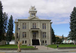
government representing the majority of the county's nonagricultural employment. Dayton, the largest town and county seat, recorded a population
of 2,655 in the 2000 Census. Dayton is well known for the historic preservation of its downtown.
Neighboring Counties
Bordering counties are as follows:
- Whitman County, Washington - north
- Garfield County, Washington - east
- Wallowa County, Oregon - southeast
- Umatilla County, Oregon - southwest
- Walla Walla County, Washington - west
- Franklin County, Washington - northwest
Education


Click Image to Enlarge
