


Click Image to Enlarge
Washington Counties
There are thity-nine counties in the state of Washington. Washington was carved out of the western part of Washington Territory and admitted to the Union as the 42nd state in 1889. The first counties were created from unorganized territory in 1845.Garfield County, Washington
Garfield County Education, Geography, and History
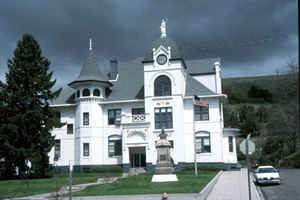
Garfield County is a county located in the state of Washington. Based on the 2010 census, the population was 2,266, making it the least populous county in Washington; with about 3.2 inhabitants per square mile (1.2/km2), it is also Washington's least densely populated county. The county seat and only city is Pomeroy.
Etymology - Origin of Garfield County Name
James Abram Garfield, the twentieth president of the United States, who had been assassinated in September, 1881
Demographics:
County QuickFacts: CensusBureau Quick Facts
Garfield County History
Garfield County was created out of a large piece of Columbia County on November 29, 1881 Roughly half of the county was split off to form Asotin County in 1883, and was named for the late US President James A. Garfield, who had been assassinated in September, 1881 Garfield County, located in southeastern Washington, had a population in 2000 of 2,397, making it the least populated of Washington's 39 counties. Its largest town (and county seat), Pomeroy, recorded a population of 1,517 in the 2000 Census.
Economic
Garfield County is located in the Southeast corner of Washington State, bordered on the north by the Snake River and on the South by the Blue Mountains, between Columbia and Asotin Counties. Historically an agricultural region, Garfield County's business economy is based largely in service, retail and small production. The county supports one port district, the Port of Garfield, and is serviced by overland transportation along US Highway 12, with connections to major interstates. Friendly customer service, quality K-12 education, local health services, and year-round recreation add to the rural charm of this neighborly community, creating a safe and inviting environment for families and businesses.
Geography: Land and Water
As reported by the Census Bureau, the county has a total area of 718 square miles (1,860 km2), of which, 711 square miles (1,840 km2) of it is land and 8 square miles (20 km2) of it (1.06%) is water. It is part of the Palouse, a wide and rolling prairie-like region of the middle Columbia basin.
Agriculture has long dominated Garfield County's economy with farms occupying two-thirds of the land in the county. Wheat has long been the
dominant crop, though other grains such as barley also are grown. At 710.5 square miles, Garfield County is the seventh-smallest county in the
state. It is bordered by Columbia County to the west, Asotin County to the east, and the Snake River to the north, with the Snake River Canyon
in places descending well over 1,000 feet to the river. The Oregon state line marks Garfield County's southern border. The northern part of
the county is a fertile plain; farther south elevations rise to the Blue Mountains near the Oregon state line.
Neighboring Counties
Bordering counties are as follows:
- Whitman County, Washington - north
- Asotin County, Washington - east
- Wallowa County, Oregon - south
- Columbia County, Washington - west
Education


Click Image to Enlarge
