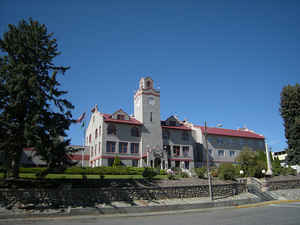
Washington Counties
There are thity-nine counties in the state of Washington. Washington was carved out of the western part of Washington Territory and admitted to the Union as the 42nd state in 1889. The first counties were created from unorganized territory in 1845.Okanogan County, Washington
Okanogan County Education, Geography, and History

Okanogan County is a county located in the state of Washington. Based on the 2010 census, the population was 41,120. The county seat is
Okanogan, while the largest city is Omak. In area, it is the largest county in the state.
Approximately 20 percent of residents live in the Greater Omak Area. The county forms a portion of the Okanogan Country. The first county seat
was Ruby, Washington, which has now been a ghost town for more than 100 years.
Okanogan County was formed out of Stevens County on February 2, 1888.
Etymology - Origin of Okanogan County Name
The name derives from the Okanagan language place name ukʷnaqín. The name Okanogan (Okanagan) also refers to the region that encompasses part of southern British Columbia.
Demographics:
County QuickFacts: CensusBureau Quick Facts
Okanogan County History
Okanogan County was created 2 February 1888 from Stevens County. Okanogan County, often called The Okanogan, is home to 38,400 people including members of the Colville Federated Tribes on the Colville Indian Reservation. The area was one of the last in Washington settled by whites because of its remoteness, but it was an early thoroughfare for prospectors enroute to gold fields in British Columbia. In the twenty-first century, the county earns its living from agriculture and forestry with tourism offering additional opportunities. Grand Coulee Dam, the largest producer of electricity in the US, sits astride the Columbia River at the county's southern boundary.
Geography: Land and Water
As reported by the Census Bureau, the county has a total area of 5,315 square miles (13,766 km2), of which,
5,268 square miles (13,644 km2) of it is land and 47 square miles (122 km2) of it (0.89%) is water
Neighboring Counties
Bordering counties are as follows:
- Ferry County, Washington - east
- Lincoln County, Washington - southeast
- Grant County, Washington - south
- Douglas County, Washington - south
- Chelan County, Washington - southwest
- Skagit County, Washington - west
- Whatcom County, Washington - west
It also shares its northern border with British Columbia, Canada.
- Okanagan-Similkameen Regional District, British Columbia
- Kootenay Boundary Regional District, British Columbia
Education


