


Click Image to Enlarge
Washington Counties
There are thity-nine counties in the state of Washington. Washington was carved out of the western part of Washington Territory and admitted to the Union as the 42nd state in 1889. The first counties were created from unorganized territory in 1845.Skamania County, Washington
Skamania County Education, Geography, and History
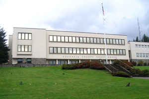
Skamania County is a county located in the state of Washington. Based on the 2010 census, the population was 11,066. The county seat and
largest incorporated city is Stevenson, although the Carson River Valley CDP is more populous. The county was founded in 1854 and derives its
name from the Cascades Chinook word sk'mániak, meaning "swift waters".
Skamania County is included in the Portland-Vancouver-Hillsboro, OR-WA Metropolitan Statistical Area.
Etymology - Origin of Skamania County Name
Skamania derives its name from the Cascades Chinook word sk'mániak, meaning "swift waters".
Demographics:
County QuickFacts: CensusBureau Quick Facts
Skamania County History
Skamania County was created 9 March 1854 from Clark County. Skamania County on the Columbia River in Southwest Washington is home to several of the state's most famous features including Mount St. Helens in the northwest and Bonneville Dam in the southeast. It has the distinction of having been created by the Washington Territorial Legislature, abolished, then recreated. The county's story was shaped by the river and particularly by the rapids called The Cascades B that divided the lower from the middle Columbia. Skamania has always been tied to the economy and politics of Oregon and of Portland, the principal seaport on the Columbia. In the last years of the twentieth century, the economy shifted away from logging, and tourism became the dominant industry. Half of Skamania County's workers are employed outside the county. In 2005, the estimated population was 10,664.
Geography: Land and Water
As reported by the Census Bureau, the county has a total area of 1,684 square miles (4,361 km2), of which,
1,656 square miles (4,290 km2) of it is land and 27 square miles (71 km2) of it (1.63%) is water. 90% of Skamania is
forested and 80% is a part of Gifford Pinchot National Forest.
Neighboring Counties
Bordering counties are as follows:
- Lewis County, Washington - north
- Yakima County, Washington - northeast
- Klickitat County, Washington - east
- Hood River County, Oregon - south
- Multnomah County, Oregon - southwest
- Clark County, Washington - west
- Cowlitz County, Washington - west
Education


Click Image to Enlarge
