


Click Image to Enlarge
Washington Counties
There are thity-nine counties in the state of Washington. Washington was carved out of the western part of Washington Territory and admitted to the Union as the 42nd state in 1889. The first counties were created from unorganized territory in 1845.Spokane County, Washington
Spokane County Education, Geography, and History
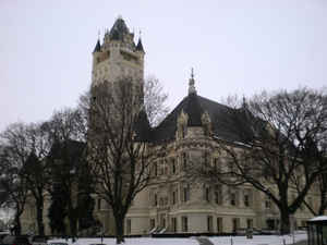
Spokane County is a county located in the state of Washington. Based on the 2010 census, the population was 471,221, making it the
fourth-most populous county in Washington state The largest city and county seat is Spokane, the second largest city in the state, behind
Seattle.
Spokane County was formed on January 29, 1858. It was annexed by Stevens County on January 19, 1864, and re-created on October 30, 1879. It is
named after the Spokane tribe.
Spokane County comprises the Spokane-Spokane Valley, WA Metropolitan Statistical Area.
Etymology - Origin of Spokane County Name
The Spokane Native American tribe.
Demographics:
County QuickFacts: CensusBureau Quick Facts
Spokane County History
Spokane County was created 29 January 1858 from Walla Walla County. Abolished 19 January 1863 and merged with Stevens County. Recreated October 30, 1879 from Stevens County. Spokane County is the most populous county in mainly rural Eastern Washington and home to the second largest city in the state. After settlement in the 1870s, Spokane became the hub for the mining, timber, and railroad industries of the Inland Northwest. In the surrounding areas, cattle ranging and especially wheat farming became important. Today, the city and county of Spokane serve as the medical, financial, and commercial center of a vast region stretching from the Cascades eastward into western Montana. Fairchild Air Force Base is the county's largest employer, and agriculture remains a factor.
Geography: Land and Water
As reported by the Census Bureau, the county has a total area of 1,781 square miles (4,612 km2), of which,
1,764 square miles (4,568 km2) of it is land and 17 square miles (44 km2) of it (0.96%) is water. It is part of the
Palouse, a wide and rolling prairie-like region of the middle Columbia basin. The lowest point in the county is the
Spokane River behind Long Lake Dam (boundary of Stevens County) at 469 meters (1,538 feet) above sea level. (There
is virtually no change in elevation between the dam and the mouth of the Little Spokane River inside Riverside State
Park.) The highest point in the county is Mount Spokane at 1,793 meters (5,883 feet).
Neighboring Counties
Bordering counties are as follows:
- Pend Oreille County, Washington - north
- Bonner County, Idaho - northeast
- Kootenai County, Idaho - east
- Benewah County, Idaho - southeast
- Whitman County, Washington - south
- Lincoln County, Washington - west
- Stevens County, Washington - northwest
Education


Click Image to Enlarge
