


Click Image to Enlarge
West Virginia Counties
There are fifty-five counties in the state of West Virginia. Fifty of them existed at the time of the Wheeling Convention in 1861, before which West Virginia was part of the state of Virginia. The remaining five (Grant, Mineral, Lincoln, Summers and Mingo) were formed within the state after its admission to the United States on June 20, 1863. At that time, Berkeley County and Jefferson County, the two easternmost counties of West Virginia, refused to recognize their inclusion in the state. In March 1866, the US Congress passed a joint mandate assenting to their inclusion.McDowell County, West Virginia
McDowell County Education, Geography, and History
McDowell County is a county in the state of West Virginia. Based on the 2010 census, the population was 22,113. Its county seat is Welch. McDowell county is the southernmost county in the state. It was created in 1858 by the Virginia General Assembly and named for Virginia Governor James McDowell. It became a part of West Virginia in 1863, when several counties seceded from the state of Virginia during the American Civil War.
Etymology - Origin of McDowell County Name
In honor of James McDowell, Governor of Virginia, 1843-46
Demographics:
County QuickFacts: CensusBureau Quick Facts
Early History of McDowell County, West Virginia
McDowell County was created by an act of the Virginia General Assembly on February 28, 1858, from parts of Tazewell County (Virginia). The county was named in honor of James McDowell (1795-1851). The son of Irish immigrants, he served as a member of the Virginia Assembly (1831-1843), was the 25th Governor of Virginia (1843-1846), and represented Virginia in US House of Representatives from 1846 until his death in 1851.
In an effort to raise revenue following the American Revolutionary War, the newly formed federal government sold vast areas of unoccupied land to land speculators, typically as low as three cents per acre. In 1794, three large land grants were sold that covered all of the present county and more. Wilson Cary Nicholas purchased a land grant of 300,000 acres and another 320,000 acre land grant with Jacob Kenney. This latter land grant was said to have covered most of the present McDowell County. It was sold the following year to Robert Morris (1734-1806), the famous wealthy financier who was a signer of the Declaration of Independence, used his financial fortune to underwrite the expenses of the American Revolutionary Army, and, late in life, lost his fortune and spent three years in debtor's prison. Also, in 1794, David Paterson purchased a 150,00 acre land grant that may have included a small portion of the present county. He sold it to Robert Pollard the following year. Thus, in 1795, Robert Morris owned nearly all of land that is now known as McDowell County.
Mathias Harman and his wife Lydia were the first English settlers in the present county. They lived in a cabin along the Dry Fork River as early as 1802. In 1829, William Fletcher was issued a patent for 20 acres of land at the mouth of Little Indian Creek in the present city limits of Welch. In 1825, Moses A. Cartwright and his wife Clary also moved to the present location of Welch. Other early settlers within the county were John and James Milam, Philip Lambert and Amos Totten.
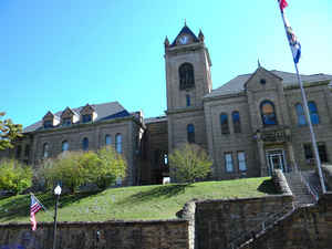
The county had only 282 land-owning families (called freeholders) when it was formed in 1858. The act creating the county specified that the county seat was to be located at Perryville, and the initial meetings of the county court where held there, in the home of George W. Payne. The construction of a courthouse, jail and other public buildings was delayed, however, due to a dispute concerning the ownership of the site selected (its title was vested in minors) and a lawsuit concerning the commission appointed to make the selection. The delay continued and extended through the Civil War years, with the court meetings taking place throughout the county. In 1867, the West Virginia state legislature passed a law locating the county seat on the lands of Philip Lambert, near Coalwood. Then, in 1872 the state legislature allowed the county residents to select the location of the county seat and they choose Perryville, then the largest town in the county. As the population around Welch increased during the early 1890s, the citizens of that town demanded that the county seat be moved there. In 1892, the residents of the county voted to move the county seat to Welch. The citizens of Perryville contested the election, claiming that the citizens of Welch had cheated by importing numerous railroad workers who had no intention to staying in the county and paid them to vote for Welch. To avoid violence, shortly after the election James A. Strother and Trigg Tabor secretly moved the county records from Perryville to Welch in two wagons. The county seat has remained in Welch since 1892.
Welch was settled in the early 1820s by William Fletcher. However, the town did not grow until the late 1880s. In 1880, there were only two or three houses and one store, owned by Squire W. G. Hunt, in the "town." In 1885 (or 1888), Captain Isaiah Welch surveyed the area as a potential site for a logging or mining operation. He, along with J. G. Bramwell and J. H. Duhring, purchased about 165 acres of land from John Henry Hunt, comprising most of present day Welch. The deal was reportedly for $40 and Captain Welch's sorrel mare, Cellum (other accounts report that the "$40 and a horse" was a deposit to bind the deal, a deed was later recorded suggesting that the real price was $2,155.75). Captain Welch's investment paid off when the railroad reached the town in the fall of 1891. Now that the town had access to the "outside" world, it became more attractive as a place to live and work. As the town began to grow, Captain Welch and his partners platted the town into lots for sale in 1893. The town was incorporated and named in honor of Captain Welch in 1894.
The nation's first war memorial dedicated to the actions of African-American veterans of World War I is located at Kimball. Also, McDowell County has the distinction of being the home of Minnie Buckingham Harper (R-McDowell) who became the first female, African-American state legislator in the United States when she was appointed to the West Virginia House of Delegates on January 10, 1928 by Governor Howard Gore to fill a vacancy caused by the death of her husband.
Geography: Land and Water
McDowell County, the southernmost county in West Virginia. It is bordered by Tazewell County, Virginia, to the south; Buchanan
County, Virginia, to the west; Mingo County to the northwest; Wyoming County to the north; and Mercer County to the east. The Appalachian
Mountains determine most of the borders of the county.
As reported by the Census Bureau, the county has a total area of 535 square miles (1,390 km2), of which 533 square miles (1,380 km2) is
land and 1.4 square miles (3.6 km2) (0.3%) is water.
The county is roughly in the shape of a semi circle, with the border following the mountains around the county.
Neighboring Counties
Bordering counties are as follows:
- East: Mercer County
- Northeast: Wyoming County
- Northwest: Mingo County
- Southeast: Tazewell County, Va.
- Southwest: Buchanan County, Va.
Education
McDowell County Schools operates the county's public K-12 education system of 7 elementary schools, 2 middle schools, and 2 public high schools in McDowell County including Mount View High School, and River View High School.


Click Image to Enlarge
