


Click Image to Enlarge
West Virginia Counties
There are fifty-five counties in the state of West Virginia. Fifty of them existed at the time of the Wheeling Convention in 1861, before which West Virginia was part of the state of Virginia. The remaining five (Grant, Mineral, Lincoln, Summers and Mingo) were formed within the state after its admission to the United States on June 20, 1863. At that time, Berkeley County and Jefferson County, the two easternmost counties of West Virginia, refused to recognize their inclusion in the state. In March 1866, the US Congress passed a joint mandate assenting to their inclusion.Roane County, West Virginia
Roane County Education, Geography, and History
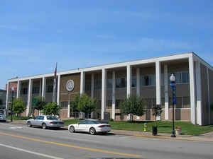
Roane County is a county located in the state of West Virginia. Based on the 2010 census, the population was 14,926. Its county seat is Spencer. The county was founded in 1856 and is named for Spencer Roane.
Etymology - Origin of Roane County Name
In honor of Judge Spencer Roane, distinguished judge of the Supreme Court of Appeals of Virginia, and son-in-law of Patrick Henry
Demographics:
County QuickFacts: CensusBureau Quick Facts
Early History of Roane County, West Virginia
Roane County was created by an act of the Virginia General Assembly on March
11, 1856 from parts of Gilmer, Jackson and Kanawha counties. It was named in
honor of Judge Spencer Roane (1762-1822)
Spencer Roane was born in Essex, Virginia on April 4, 1762. He studied the law
and was appointed a judge of the Virginia general court in 1789 and a judge of
the Virginia court of errors in 1794. He was appointed a justice of the Virginia
Supreme Court of Appeals in 1795 and served in that office until his death in
1822. He was a member of the commission that helped in the establishment of the
University of Virginia in 1819. He died on September 4, 1822. His wife, Anne,
was the daughter of Patrick Henry and his nephew, Thomas Ritchie, was one of the
nation's leading publishers and the namesake for Ritchie County. It is said that
his name was honored as the namesake for the county because of a simple act of
kindness. According to the story, as a young boy J.P. Tomlinson's wagon became
stuck in the mud. Judge Roane happened by and helped the boy free the wagon.
Tomlinson never forgot the kindness and decades later, when laying the petition
to form the new county before the Virginia General Assembly, he recommended that
the new county be named in Judge Roane's honor.
Jesse Hughes was probably the first Englishman to set foot in present Roane
County. He led a small party of explorers through the Little Kanawha Valley in
1772. Many of his and his wife's, Grace (Tanner) Hughes, descendants became the
county's earliest settlers.
Spencer, the county seat, was patented by Albert Gallatin in 1787. The first settlers in the town were Samuel Tanner, his wife, Sudnar, and their child, and a man called Wolf, who lived with the Tanner family. They arrived in 1812. They found shelter in a cave while they built themselves a cabin. Several years later, more setters arrived, including J.S. Spencer, a school teacher. The town was then named Tanner's Cross Road, primarily because two paths bisected the town. It was later known as Cassville. In 1840, Raleigh Butcher, intending to go to California, came to where Spencer now stands and built a large frame house. The town then became known as New California, because it was the place where Butcher had stopped on his way west. The first meeting of the Roane county court was held at the home of M. Benson Armstrong on April 7, 1856 in New California. Later that year the county's voters selected New California as the site for their county seat. In 1858, the town was chartered by the Virginia General Assembly and renamed Spencer, presumably in honor of Judge Spencer Roane, although a weaker case can be made that it was also named in honor one of the town's first school teachers, J. S. Spencer. The town was incorporated on February 20, 1867.
Geography: Land and Water
As reported by the Census Bureau, the county has a total area of 484 square miles (1,250 km2), of which 484 square miles (1,250 km2) is land and 0.2 square miles (0.52 km2) (0.03%) is water
Neighboring Counties
Bordering counties are as follows:
- North: Wirt County
- Northeast: Calhoun County
- Northwest: Jackson County
- Southeast: Clay County
- Southwest: Kanawha County
Education


Click Image to Enlarge
