


Click Image to Enlarge
West Virginia Counties
There are fifty-five counties in the state of West Virginia. Fifty of them existed at the time of the Wheeling Convention in 1861, before which West Virginia was part of the state of Virginia. The remaining five (Grant, Mineral, Lincoln, Summers and Mingo) were formed within the state after its admission to the United States on June 20, 1863. At that time, Berkeley County and Jefferson County, the two easternmost counties of West Virginia, refused to recognize their inclusion in the state. In March 1866, the US Congress passed a joint mandate assenting to their inclusion.Taylor County, West Virginia
Taylor County Education, Geography, and History
Etymology - Origin of Taylor County Name
For Senator John Taylor (1750-1824), distinguished soldier and statesman of Virginia
Demographics:
County QuickFacts: CensusBureau Quick Facts
Early History of Taylor County, West Virginia
Taylor County was created by an act of the Virginia General Assembly on January 19, 1844 from parts of Barbour, Harrison and Marion counties. Although some historians claim that the county was named for General Zachary Taylor (1784-1850), known as "Old Rough and Ready" and the 12th President of the United States (1849-1850), most claim that the county was actually named in honor of Senator John Taylor (1750-1824), a distinguished solider-statesman from Caroline County, Virginia. He graduated from William and Mary College, studied law, and was admitted to the bar in 1774. He served in the Continental Army during the American Revolutionary War, rising through the ranks to Major. He also served as a Colonel of Militia under General Lafayette during the war. He was a member of Virginia General Assembly (1779-1787) and represented Virginia in the US Senate (1792-1794, 1803, and 1822-1824). He died on August 20, 1824.
The first settlement in the county started about the year 1773 at Cross Roads, now Pruntytown. The name Cross Roads was derived from the crossing of the Washington Post Road and the Booths Ferry Pike in the town. It was later called Williamsport and was incorporated on January 1, 1801. On January 23, 1845, the town's name was changed to Pruntytown, in honor of John Prunty, the first settler in the area. The town was named the county seat when the county was formed in 1844. It continued to serve as the county seat until 1878 when the county's voters decided to move the county seat to Grafton.
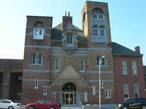
Grafton was originally settled by William Robinson in 1773. Some historians claim that the town received its name from railroad crews in the 1830s who called it "graftin" because it was the point at which a number of branch railroad lines met the railroad's mainline. Other historians suggest that the town was named in honor of John Grafton, a civil engineer employed by Colonel Benjamin Latrobe, who laid out the route across what was then northwestern Virginia for the Baltimore and Ohio Railroad Company in 1852. Once the railroad arrived, Grafton began to grow and it was incorporated on March 15, 1856. Because of the railroad lines, the town was deemed of strategic importance by both sides during the Civil War and was the site of many battles, with the town changing hands many times. In 1872, Grafton made a concerted attempt to be named the state capitol, but failed. It was named the county seat in 1878.
The only national cemetery in West Virginia is located in Grafton, on the west side of the river. It has 1,800 graves.
Anna M. Jarvis, founder of Mother's Day, was born in Webster, near Grafton, on May 1, 1864. The Mother's Day Shrine is located in Grafton.
Geography: Land and Water
Taylor County is a county located in the state of West Virginia. Based on the 2010 census, the population was
16,895. Its county seat is Grafton. The county was formed in 1844. and named for Senator John Taylor of Caroline
Taylor County is part of the Clarksburg, WV Micropolitan Statistical Area.
Neighboring Counties
Bordering counties are as follows:
- North: Monongalia County
- Northeast: Preston County
- Northwest: Marion County
- South: Barbour County
- West: Harrison County
Education


Click Image to Enlarge
