


Click Image to Enlarge
Wisconsin Counties
There are seventy-two counties in the state of Wisconsin. Wisconsin became part of the Territory of Michigan and divided into two counties: Brown County in the northeast along Lake Michigan and Crawford County in the southwest along the Mississippi River. The state of Wisconsin was created from Wisconsin Territory on May 29, 1848, with 28 counties.Adams County, Wisconsin
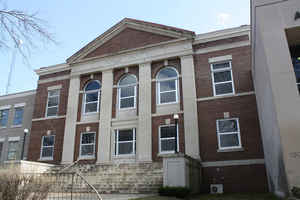
Adams County Education, Geography, and History
Adams County is a county in the state of Wisconsin. Based on the 2010 census, the population was 20,875. Its county seat is Friendship. The county was created in 1848 and organized in 1853. Sources differ as to whether its name is in honor of the second President of the United States, John Adams, or his son, the sixth President, John Quincy Adams.
Etymology - Origin of Adams County Name
Adams County was named for one of the presidents of that name. Henry Gannett, credits as the name giver, John Quincy Adams, the sixth president. History of Northern Wisconsin (Chicago, 1881), p. 60, says that this county was named for John Adams, the second president.
[Source: Wis. Hist. Colls., i, p. 112.; History of Northern Wisconsin (Chicago, 1881), p. 60; U. S. Geological Survey Bulletin, No. 197 (Washington 1902), p. 18]
Demographics:
County QuickFacts: CensusBureau Quick Facts
Adams County History
Adams County, created in 1848 from Portage County, is named after John Quincy Adams. Located in central Wisconsin, the county seat is Friendship.
The area covered by present-day Adams County has been part of several other counties throughout Wisconsin's history.
In 1840, when Wisconsin was still a territory, Adams County was the south-western section of Brown County (today,
Brown County includes the area around the southern part of Green Bay). In 1836, Portage County was created and
included most of present day Columbia County, including the city of Portage, Wisconsin. In 1846, Portage County was
renamed Columbia County. The area from the northern boundary of Columbia County to Lake Superior was removed from Brown
County and was then called Portage County. In 1848, the southern part of Portage County was renamed Adams County and
included all of current-day Adams County and the northern section of Juneau County. In 1858, The northwestern part of
Adams County was joined with the northern part of Sauk County to form present-day Juneau County. At this time, Adams
County took its current shape.
In many important ways, the history of Adams County is linked closely with the history of transportation and the
resources in search of which travelers set forth. Beginning with the native peoples who first settled the area, its
western border on the Wisconsin River and its prominent natural landmarks placed Adams County along trading routes.
European-American settlement did not begin in earnest until 1838 when a small tract was ceded to Jared Walsworth and
his Menomonee wife. His tavern, located along the Pinery Road, the overland route of the northern pine forests,
induced the first wayfarers to stay in Adams County. In 1848, the same year Wisconsin became a state, the Menomonee
relinquished their claim to the entire Wisconsin River Valley.
By 1860 the population reached six thousand, mainly relocated Easterners attracted by the ready supply of white pine
for buildings and heating their homes. The tumbling water of the county's many creeks and rivers powered their
sawmills.
Friendship was founded by settlers coming from Friendship, New York. Today, Adams is the largest community in Adams County, but this was not always so. In the 1880s, there were plans for a railroad that connected Chicago and St. Paul to pass through Friendship. It appears that once this was decided, local landowners increased their demands. Instead of paying more for the land in Friendship, the railroad placed the tracks two miles south of Friendship. To service workers, boxcars were stacked to form housing, and the town of Adams was created. This stretch of track would become the famous "400" route. Today, Adams has about 3 times as many people as Friendship.
The railroads, however, continued to skirt Adams County until the next century. As a result, the population increased very little until immigrants from Germany, Bohemia, and Poland, drawn by the promises of inexpensive and fertile farmland, settled here in the 1890s.
The Chicago & North Western Railroad did not arrive until 1910. But the county seat of Friendship, incorporated as a
village three years earlier, remained with out a depot when land speculation forced the railroad to lay their track
south of the village limits, around which grew the town of Adams.
Through a development and tourism boom in the towns of Quincy and Dellwood brought a degree of prosperity in the
1920s. Adams County, reliant on agriculture, suffered severely through the drought and depression of the 1930s.
Transportation improvements again brought new life to Adams County in the 1940s when the Wisconsin River Power
Company began construction on the dams creating Castle Rock and Pentenwell Lakes. A bridge was built to span the
Wisconsin in the 1950s, and the Interstate Highway System brought visitors and urban expatriates to Adams County.
From 1970 to the present, owing to the county's increased accessibility, and thanks to the recreational lakes and
subdivisions built in the Town of Rome, Adams County witnessed its greatest expansion, second fastest in the state,
and population increase since it was first settled.
ADAMS.--Population 6,467
From: Handbook of Wisconsin by S. Silas, 1855
pg. 46,47,48
This County lies on the Wisconsin, and is also watered by the Lemonwier, Neceda, Yellow, Roche a Cre, and
numerous smaller steams. The valley of the Lemonwier contains as good land for agricultural purposes, as any in the
State. The valley is some forty miles long by twenty in width, is gently undualating, intersected by many beautiful
streams of the purest soft water; and what adds much to the value of the land is the existence of water everywhere
at a depth of to twenty feet below the surface.
The timber consists of black, white, and bury oak, with an occasional mixture of popular, maple and basswood, oak
openings predominate, yet there are many groves of dense forest. The soil there is warm, quick, and exceedingly
productive. Pine of excellent quality is cut on the upper waters of the Lemonwier and Yellow Rivers, which has
brought into existence numerous saw mills on the lower waters, and numerous thriving villages are springing up
around them.
Between the Yellow and Lemonwier Rivers, the country is level, in the rest of the county generally undulating, and
good for agriculture. There is much good subject to entry, and it will not be long before Adams county will contain
a large population. The land office for nearly the whole of this county is at Steven's Point.
Germantown, on the Wisconsin, at the mouth of the Yellow River, is the county seat, and has a good location for
future prosperity. It is in the centre of a fertile district which is rapidly settling. Eight saw mills on the
Yellow River, and all doing a prosperous business, send their lumber down the River to the Wisconsin, at this place.
Mauston, on the Lemonwier, is the largest village, having the usual indications of growth in its hotels, stores,
shops, &c. It is located at one of the best water powers on the river, on which are a saw mill, lathe and picket
mill, &c. A flouring mill is soon to be erected. Most of the pine from above is manufactured into lumber at this
point. Maugh's Mills is the name of the Post Office.
Quincy, Cascade, Dell Prairie, Neceda, Dustin's Mills, and Wauceda, are all new and flourishing villages.
The County is healthy, and affords good inducement, not only to the farmer, but to the mechanic of almost every
kind.
The La Crosse and Milwaukee Rail Road passes through this county, following up the west side of the Wisconsin River
to the Lemonwier, and up the Valley of this River to Monroe County.
By an act of the Legislature passed during the session of 1855, this county is divided by the Wisconsin River,
making the County of Juneau on the west side, subject to approval by the voters of the County in November. There is
little doubt the County will be so divided.
Geography: Land and Water
As reported by the Census Bureau, the county has a total area of 689 square miles (1,783 km2), of which, 648
square miles (1,678 km2) of it is land and 41 square miles (106 km2) of it (5.92%) is water.
Neighboring Counties
Bordering counties are as follows:
- Wood County - northwest
- Portage County - northeast
- Waushara County - east
- Marquette County - east
- Columbia County - southeast
- Sauk County - southwest
- Juneau County - west
Education


Click Image to Enlarge
