


Click Image to Enlarge
Wisconsin Counties
There are seventy-two counties in the state of Wisconsin. Wisconsin became part of the Territory of Michigan and divided into two counties: Brown County in the northeast along Lake Michigan and Crawford County in the southwest along the Mississippi River. The state of Wisconsin was created from Wisconsin Territory on May 29, 1848, with 28 counties.Bayfield County, Wisconsin
Bayfield County Education, Geography, and History
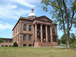
Bayfield County is a county located in the state of Wisconsin. Based on the 2010 census, the population was 15,014. Its county seat is Washburn. The county was created in 1845 and organized in 1850
Etymology - Origin of Bayfield County Name
Bayfield (originally La Pointe) County The original name was the French appellation for the entire locality about Chequamegon Bay, named "La
Pointe de Chequamegon," by Father Allouez. The Jesuit mission there established by him in 1665 was known as La Pointe du St. Esprit - see Wis.
Hist. Colls., xiii, p. 404, and accompanying note. In the eighteenth century, the French post here established was frequently spoken of as "La
Pointe" (for an example, see Wis. Hist. Colls., xvii, p. 9), although the official designation was Chequamegon. The name La Pointe was finally,
in the nineteenth century, limited to the trading village on Madeline Island, for which place the county was named. About 1857 the town of Bayfield
was established, being promoted by Henry M. Kice of St. Paul, who named it for Admiral Henry W. Bayfield, R. N., who surveyed Lake Superior for the
English government in 1823-25. Bayfield (1795-1865) first came to America in 1814, and from 1817-25 was employed as admiralty surveyor for the Great
Lakes; later, he performed a like service for the river and gulf of St. Lawrence, dying at Charlottetown, P. E. I., after attaining the rank of admiral
Demographics:
County QuickFacts: Census Bureau Quick Facts
Bayfield nCounty History
Originally, it was named La Pointe County, Wisconsin.
Renamed Bayfield in 1866
Established: 1845
County Seat: Washburn
Parent: Ashland County
John W. Hunt's 1853 Wisconsin Gazetteer:
"LA POINTE [modern Bayfield], County, is bounded on the northwest and north by the State line, in Lake Superior, on the east by Marathon, on the the south by Chippewa and St. Croix, and west by Minnesota. It was set off from St. Croix Feb. 19, 1845 and it was fully organized 9th Feb. 1850. The county seat is established at La Pointe, on the southeast end of Madeline Island, in Lake Superior, the oldest settlement in the State. The county is watered by Bois Brule, (Burnt Wood,) Mauvais, (Bad,) or Maskau rivers, and other small streams entering the lake from three to ten miles apart, and by lakes. The country, for a short distance along the margin of the lake, is low and wet; further south it is generally rolling. The western portion of the country is prairie land; and the soil being good and winters mild, offers great inducements to agriculturists. In the more eastern parts, the timber in most places is very thick, comprising white and yellow Norway pine, and the different species of oak, maple, birch, and the soft woods. French missionaries visited this country as early as 1661. In 1850 the population was 489; 5 farms and 74 dwellings."
[Source: Kellogg, Louise Phelps. "Derivation of County Names" in Proceedings of the State Historical Society of Wisconsin
for 1909, pages 219-231.]
LA POINTE.
From: Handbook of Wisconsin by S. Silas, 1855
pg. 81
Lies on Lake Superior, and embraces a territory about 54 miles square, and the group of islands in the Lake known as the Twelve Aportles. The land
is not yet surveyed, and of course not in market. But little is known of the country. The County Seat is on the south-west extremity of Madeline Island,
which gives its name to the village and county--"The Point.". La Pointe village is the oldest settlement of the State, not excepting Green
Bay. It is the best fishing ground on the whole Lake for trout, siscoette, and white fish, more than a thousand barrels of which are annually packed
at this place.
Geography: Land and Water
As reported by the Census Bureau, the county has a total area of 2,042 square miles (5,288 km2), of which, 1,476 square miles (3,823
km2) of it is land and 565 square miles (1,464 km2) of it (27.69%) is water
Neighboring Counties
Bordering counties are as follows:
- Ashland County - east
- Sawyer County - south
- Washburn County - southwest
- Douglas County - west
Education


Click Image to Enlarge
