


Click Image to Enlarge
Wisconsin Counties
There are seventy-two counties in the state of Wisconsin. Wisconsin became part of the Territory of Michigan and divided into two counties: Brown County in the northeast along Lake Michigan and Crawford County in the southwest along the Mississippi River. The state of Wisconsin was created from Wisconsin Territory on May 29, 1848, with 28 counties.Iowa County, Wisconsin
Iowa County Education, Geography, and History
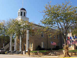
Iowa County is a county located in the state of Wisconsin. Based on the 2010 census, the population was 23,687. Its county seat and largest
city is Dodgeville. When created, it was part of the Michigan Territory.
Iowa County is part of the Madison, Wisconsin, Metropolitan Statistical Area
Etymology - Origin of Iowa County Name
The county derives its name from the powerful and, at one time, invincible Iowa tribe, whose hunting grounds engrossed the territory which has since proved the foundation of several states.
Demographics:
County QuickFacts: CensusBureau Quick Facts
Iowa County History
John W. Hunt's 1853 Wisconsin Gazetteer
"IOWA, County, is bounded on the north by Richland and Sauk, on the east by Dane and a portion of Green, on the south by Lafayette, and on the west by Grant. It was formed from Crawford by an act of the legislative assembly of Michigan October 9, 1829, at which time it included all of the present State of Wisconsin, south of the Wisconsin river, and west of "a line drawn due north from the northern boundary of Illinois, through the middle of the Portage between the Fox and Wisconsin rivers." The seat of justice is at Mineral Point. It is watered by branches of the Peckatonnica river, Blue river, and Mineral and Pipe creeks. The county contains about 750 square miles, and is eminently a mining county, but is also equally valuable for its agricultural resources. The soil is not surpassed in fertility by any in the State. Prairie and timber land in about equal proportions. The wheat or corn crop along the Wisconsin river never fails. The population is composed of Americans, Germans, English, Welsh, and Irish. The whole northern portion of the county, to a distance of eight or ten miles from the Wisconsin river, is peculiarly an agricultural country, and unsurpassed for stock raising. South from this, the mineral region extends in every direction, over prairie and woodland. The central and southern portion of the county is a mining country, but none the less adapted to farming, for its rich soil and abundant water render any part of it attractive. Prairie and timber alternately predominate. Streams of water meander through every ravine, furnishing not only irrigation for the land but a large quantity of water power. The ague and fevers of the West are unknown here. The advantages of this county are briefly, health, mineral wealth, agricultural resources, and abundant water power. The railroad to State line and connection with Chicago will give the settlers here a constant market. The population in 1830 was 1,589; 1836, 3,218; 1838, 5,234; 1840, 3,978; 1842, 5,029; including Richland;1846, 14,905; 1847, 7,963; 1850,10,479."
[Source: History of Iowa County, p.438]
IOWA.--Population 14,440.
From: Handbook of Wisconsin by S. Silas, 1855
pg. 75
This is a mineral County, and one of the richest. It has a large trade in lead and copper which centers at
Mineral Point. There are few countries abounding in minerals where the soil pays a fair remuneration to the
cultivator. Yet the soil of this and the neighboring Counties, is as good and as fruitful as any in Wisconsin. There
is no better for Indian corn, and it is not surpassed for other products of the State. The surface is abruptly
rolling, well watered, being prairie and openings. There is some good land not yet taken up.
Mineral Point, the County Seat, is the largest and oldest village in that region. It is a thrifty place, the center
of a large mineral trade, and has smelting furnaces of lead and copper. It bids fair to be a large place, and will
soon have an outlet in the Mineral Point Rail Road, down the Pickatonica to the State line, to unite with the
Chicago and Galena at Freeport. The Milwaukee and Mississippi Rail Road is to pass along the northern boundary.
Geography: Land and Water
As reported by the Census Bureau, the county has a total area of 768 square miles (1,989 km2), of which, 763 square miles (1,975 km2) of it is land and 5 square miles (14 km2) of it (0.70%) is water.
Neighboring Counties
Bordering counties are as follows:
- Richland County - northwest
- Sauk County - northeast
- Dane County - east
- Green County - southeast
- Lafayette County - south
- Grant County - west
Education


Click Image to Enlarge
