


Click Image to Enlarge
Wisconsin Counties
There are seventy-two counties in the state of Wisconsin. Wisconsin became part of the Territory of Michigan and divided into two counties: Brown County in the northeast along Lake Michigan and Crawford County in the southwest along the Mississippi River. The state of Wisconsin was created from Wisconsin Territory on May 29, 1848, with 28 counties.Menominee County, Wisconsin
Menominee County Education, Geography, and History
Menominee County is a county in the state of Wisconsin. Based on the 2010 census, the population was 4,232 making it the least populous
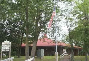
county in Wisconsin. Its county seat is Keshena.
Menominee is Wisconsin's newest county, having been created in 1959 after the Menominee Tribe was terminated by federal law. In 1974 the tribe
regained federal recognition and restoration of most of its reservation. Today Menominee County is essentially coterminous with the boundaries
of the federally recognized Menominee Indian Reservation.
Memoninee County is included in the Shawano, WI Micropolitan Statistical Area, which is also included in the Green Bay-Shawano, WI Combined
Statistical Area.
Etymology - Origin of Menominee County Name
Name derived from the Chippewa word "Manomini-sibi," from "omanominig," meaning "wild rice people."
When Nicolet in 1634 stepped ashore not far from the present site of Green Bay, the Menominees were living in peace with
their neighbors on both sides of the Menominee River, on the present sites of Menominee. Michigan, and Marinette,
Wisconsin. Language and legend stamp them as Algonquians. Their name was bestowed upon them by the Chippewa and means
"The People of the Wild Rice." As white settlers encroached on their lands and treaties were made with the US
Government, the Menominees moved reluctantly from one place to another. By 1831, they had transferred to eastern Indians
half a million acres at 4 1/2 cents per acre and another half million acres to the Government at 5 1/2 cents per acre,
the money to be paid in annuities. When Wisconsin became a Territory in 1836, they were compelled to sell 184,320 acres
through the Fox River Valley for settlement and lumbering at 17 cents per acre, and they had to move again. In 1848 the
Government sought to move them to the Crow Wing country of Minnesota, but this time the Menominees under the leadership
of Chief Oshkosh refused to move. In 1852 they moved up the Wolf River where in 1854 they were granted ten town-ships,
and the present Menominee Indian Reservation.
[Source: McBride, Sarah Davis. History Just Ahead (Madison:WHS, 1999).]
Demographics:
County QuickFacts: CensusBureau Quick Facts
Menominee County History
The county was created on July 3, 1959 in anticipation of the termination of the Menominee Indian Reservation in 1961. The reservation status was restored in 1973, and is now co-extensive with the county. Most of the land within the county boundary is under Federal Trust for the exclusive use by enrolled Menominee Indians. Scattered parcels that were purchased during Termination, as well as many lots around the Legend Lake area in the southeastern part of the county, are the only parts of the county that are privately-owned by non-Indians.
Geography: Land and Water
As reported by the Census Bureau, the county has a total area of 365 square miles (945 km2), of which, 358 square miles (927 km2) of it is land and 7 square miles (18 km2) of it (1.93%) is water.
Neighboring Counties
Bordering counties are as follows:
- Oconto County - east
- Shawano County - south
- Langlade County - northwest
Education


Click Image to Enlarge
