


Click Image to Enlarge
Wisconsin Counties
There are seventy-two counties in the state of Wisconsin. Wisconsin became part of the Territory of Michigan and divided into two counties: Brown County in the northeast along Lake Michigan and Crawford County in the southwest along the Mississippi River. The state of Wisconsin was created from Wisconsin Territory on May 29, 1848, with 28 counties.St. Croix County, Wisconsin
St. Croix County Education, Geography, and History
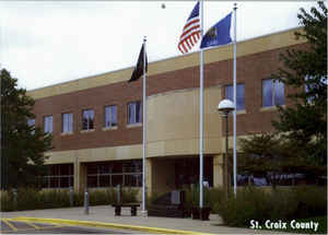
St. Croix County is a county in the state of Wisconsin. Based on the 2010 census, the population was 84,345. Its county seat is Hudson. The
county was created in 1840 (then in the Wisconsin Territory) and organized in 1849.
St. Croix County is part of the Minneapolis-St. Paul-Bloomington, MN-WI Metropolitan Statistical Area.
Etymology - Origin of St. Croix County Name
Named for its principal river. This is one of the most ancient names on the map of Wisconsin, and was so designated in honor of an early French voyageur who was wrecked at its mouth - see Wis. Hist. Colls., xvi, p. 185.
[Source: Kellogg, Louise Phelps. "Derivation of County Names" in Proceedings of the State Historical Society of Wisconsin for 1909, pages 219-231.]
Demographics:
County QuickFacts: CensusBureau Quick Facts
St. Croix County History
St. Croix County was established in 1840 by the Territorial Legislature of the Wisconsin Territory by cleaving
off portion of Crawford County north of the line formed from where Rush River empties into Lake Pepin, up the Rush
River to its first major branch (Lost Creek), then northeasterly to where Wilson Creek empties into the Red Cedar
River (in Menomonie), up the Red Cedar River to Brill River (near Rice Lake), up the Brill River, Long Lake, Slim
Creek and Slim Lake, through the Long Lake-Sissabagama (pronounced /ˌsɪsəˈbæɡəmɑː/) Lake Portage, down Sissabagama
Creek, Sand Lake, Sand Creek, Whitefish Lake and into Lac Courte Oreilles, to the eastern most point of Lac Courte
Oreilles, then northeast to the western branch of the Montreal River. St. Croix County is named after the river on
its western border. Depending on the source, St. Croix River was either named from Monsieur St. Croix, an explorer
who drowned at the mouth of the river late in the seventeenth century or from the account that said Father Hennepin
gave this region the French name Ste Croix (which means "Holy Cross") due to the all the burial markers located at
the mouth of the river.
La Pointe County was formed from the northern portions of St. Croix County in 1845. When Wisconsin was admitted into
union as a State on May 29, 1848, St. Croix County was divided into two. The portion of St. Croix County of the
residual Wisconsin Territory was re-organized a year later as part of Minnesota Territory, forming Washington,
Ramsey and Benton Counties.
St. Croix County that became part of Wisconsin became the parental county to Pierce and Polk Counties, and formed
significant portions of Dunn, Barron, Washburn and Burnett Counties.
On June 12, 1899, a deadly F5 tornado struck New Richmond. The tornado's damage path was 300 yards (270 m) wide and
30 miles (48 km) long. It killed 117 people and injured 200 others, making it the 8th deadliest tornado in US
history.
John W. Hunt's 1853 Wisconsin Gazetteer
"ST. CROIX, County, is bounded on the north by La Pointe, on the east and south by Chippewa, on the southwest and west by the boundary between the State and Minnesota. The county seat is at Hudson, formerly Willow river, at the mouth of a stream of the same name, emptying into Lake St. Croix. It was set off from Crawford, and organized January 29, 1850 The boundaries were somewhat changed March 16, 1849. It is one of the largest counties in the State, being 130 miles in length, and 50 in width; presents to the agriculturist, in fertility of soil, well watered and well wooded farms, in the means of access to market through Lake St. Croix and the Mississippi, and in the perfect healthiness and salubrity of climate, advantages which are to be found combined in but few places in the West. The surface is generally undulating north of the Falls of St. Croix. It is mostly timbered with maple and other hard woods, while south of the Falls is a due proportion of prairie and openings. But little attention has yet been paid to the pursuits of agriculture, and the manufactories are confined for the present to pine lumber. It is well watered with fine streams and beautiful lakes. The principal streams are Willow, Kinnickinnic, Vermillion, Isabelle, and Rush river. Population in 1846 was 1,419; in 1847, 1,674; in 1850, 624; with 181 dwellings, 4 farms, and 2 manufactories. In 1846 the census returns included all of the present Territory of Minnesota, east of the Wisconsin river, also the present county of La Pointe. In 1847 it included the same, excepting the county of La Pointe. This is the reason why there appears to be a decrease in the population from 1847 to 1850"
ST. CROIX.--Population, 2,040.
From: Handbook of Wisconsin by S. Silas, 1855
pg. 102-103
Is on the lower part of St. Croix River, and is one of those Counties toward which the tide of immigration is now
setting. It has all the varieties of surface, gently rolling, with prairie, openings, timber, hard and pine. Its
present principal export is pine lumber. For agricultural purposes, the land bordering on Willow and Apple Rivers,
seem to have the preference, at least most of the lands purchased by actual settlers are selected there.
It is said that about 2500 men will be employed in the St. Croix Pineries during this winter (1855 and '6.).
Pineries all over the State give some employment to many young men, who come to the State seeking a location, or who
prefer to earn something during the winter season, after the location is made.
Hudson is the County Seat, and contains the land office for the Willow River land district. It is a pleasant and
thriving village, on Lake St. Croix, six miles below Stillwater, (in Minnesota) eighteen east of St. Paul, and
twenty-two above the foot of the Lake. It possesses very decided commercial advantages, and is fast rising into
importance. It has a large and increasing intercourse with St. Louis and other river cities. Its present population
is about 1000.
Geography: Land and Water
As reported by the Census Bureau, the county has a total area of 736 square miles (1,906 km2), of which, 722 square miles (1,870 km2) of it is land and 14 square miles (36 km2) of it (1.90%) is water.
Neighboring Counties
Bordering counties are as follows:
- Polk County - north
- Barron County - northeast
- Dunn County - east
- Pierce County - south
- Washington County, Minnesota - west
Education


Click Image to Enlarge
