


Click Image to Enlarge
Wisconsin Counties
There are seventy-two counties in the state of Wisconsin. Wisconsin became part of the Territory of Michigan and divided into two counties: Brown County in the northeast along Lake Michigan and Crawford County in the southwest along the Mississippi River. The state of Wisconsin was created from Wisconsin Territory on May 29, 1848, with 28 counties.Waukesha County, Wisconsin
Waukesha County Education, Geography, and History
Waukesha County is a county in the state of Wisconsin. Based on the 2010 census, the population was 389,891, making it the third-most
populous county in Wisconsin. Its county seat is Waukesha.
Waukesha County is included in the Milwaukee–Waukesha–West Allis, WI Metropolitan Statistical Area.
Etymology - Origin of Waukesha County Name
Named when its territory was separated from Milwaukee, and erected into a county. There was a strong popular desire for an Indian name. Waukt-shaw was suggested as being the Potawatomi form of fox, because the waters of the lower part of the county drain into Fox River of Illinois (which is, however, named for the Fox tribe of Indians, not for the animal) - see Frank A. Flower, History of Waukesha County (Chicago, 1880), p. 376; also Wis. Hist. Colls., i, p. 117. The name, therefore, was not an aboriginal name of the locality, but one chosen by its early American settlers from Indian vocabularies.
[Source: Kellogg, Louise Phelps. "Derivation of County Names" in Proceedings of the State Historical Society of Wisconsin for 1909, pages 219-231.]
"Wau-ke-sha or Waukeeshah was pronounced by the Chippewas as Wau-goosh-sha and meant 'little fox.'"
[Source: Sheboygan Daily Press, 19 Mar. 1936.]
Demographics:
County QuickFacts: CensusBureau Quick Facts
Waukesha County History
Waukesha County, created in 1846 from Milwaukee County, is named for the Pottawatomi word "waugooshance" which
means "little foxes." Located in southeast Wisconsin, the county seat is Waukesha.
John W. Hunt's 1853 Wisconsin Gazetteer
"WAUKESHA, County, is bounded on the north by Dodge and Washington, on the east by Milwaukee, on the south by Walworth and Racine, on the west by Jefferson, and is 24 miles square. It was set off from Milwaukee and fully organized January 31, 1846. The eastern portion of the county is heavily timbered, while the western is divided between oak openings, prairie and marsh. The soil is good and well adapted to tillage and grazing. The county is distinguished for its numerous and beautiful lakes, there being probably more than 30 within its limits. It is watered by the Fox, (Pishtaka), Menomonee, Ashippin and Bark rivers, and Oconomowoc, Scupernong, Poplar, White and Mukwonago creeks. Population in 1846 was 13,793; 1817, 15,866; 1850, 19,324. It has 2,561 dwellings, 1,743 farms, and 78 manufactories. "
WAUKESHA.--Population 24,012.
From: Handbook of Wisconsin by S. Silas, 1855
pg. 104-105
Lies next West of Milwaukee, and was originally a part of it. The face of the country is rolling, rising in the
north-west part to high table land. East of Fox River is heavy timber, west, openings with a few small prairies.
There is considerable marsh land, but no more than is needed for hay meadows. The marshes in this and most other
portions of the State can generally be drained, and will eventually become rich meadows. The lands are nearly all
good, and well cultivated. Summit, in the north-west part, contains some of the best farms in the State. It is well
watered with streams and lakes, and has many good water powers.
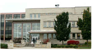
Waukesha, near the centre, is the County Seat. It has a good water power, and is the location of Carroll College,
under the charge of the Presbyterians. This institution has a fine stone building, is fully officered, and has a
well qualified corpse of instructors. Its prospects are fair, and is intended by its friends, that it shall not be
inferior to any college in the west.
Oconomowoc, on the Milwaukee and Watertown Rail Road, is a flourishing place, and does a large business.
The Milwaukee and Mississippi, and the Milwaukee and Watertown Rail Roads, both in operation, pass through the whole
length of the County. There is also a charter for a Rail Road from Waukesha down the Fox River.
Geography: Land and Water
As reported by the Census Bureau, the county has a total area of 580 square miles (1,503 km2), of which, 556 square miles (1,439 km2) of it is land and 25 square miles (65 km2) of it (4.29%) is water.
Neighboring Counties
Bordering counties are as follows:
- Washington County - north
- Ozaukee County - northeast
- Milwaukee County - east
- Racine County - southeast
- Walworth County - southwest
- Jefferson County - west
- Dodge County - northwest
Education


Click Image to Enlarge
