


Click Image to Enlarge
Wisconsin Counties
There are seventy-two counties in the state of Wisconsin. Wisconsin became part of the Territory of Michigan and divided into two counties: Brown County in the northeast along Lake Michigan and Crawford County in the southwest along the Mississippi River. The state of Wisconsin was created from Wisconsin Territory on May 29, 1848, with 28 counties.Waupaca County, Wisconsin
Waupaca County Education, Geography, and History
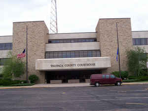
Waupaca County is a county in the state of Wisconsin. Based on the 2010 census, the population was 52,410. The county seat is Waupaca. The county was created in 1851 and organized in 1853. It is named after the Waupaca River, a Native American name meaning 'white sand bottom', 'pale water', or 'tomorrow river'.
Etymology - Origin of Waupaca County Name
Waupaca County takes its name from a river, whose Indian appellation has been variously interpreted. It is said to mean "white sand bottom" - Legler, Wis. Place Names., p. 35; and "pale water," or "to-morrow river" - Wis. Hist. Colls., iii, p. 487.
[Source: Kellogg, Louise Phelps. "Derivation of County Names" in Proceedings of the State Historical Society of Wisconsin for 1909, pages 219-231.]
Demographics:
County QuickFacts: CensusBureau Quick Facts
Waupaca County History
Waupaca County, created in 1851 from Brown and Winnebago Counties, is named for the Menominee word "wau-pa-ka-ho-nak,"
which means "white sand bottom" or "brave young hero." Located in central Wisconsin, the county seat is Waupaca.
John W. Hunt's 1853 Wisconsin Gazetteer
"WAUPACCA, County, is bounded on the north and northeast by Oconto, on the east by Outagamie, on the south by Winnebago and Waushara, and on the west by Portage. It was set off from Winnebago and established February 17, 1851, and attached thereto for judicial purposes. It is watered by the Wolf, Waupacca, Wabunk, Embarrass and Little Wolf rivers, and contains some of the best pine timber in the State. It being new, but little is known of its agricultural capacities. The county seat is at Mukwa, on Wolf river. Waupacca county belongs to the fourth judicial circuit, to the second senate and third congressional district, and with Outagamie and Oconto, sends one member to the assembly."
WAUPACCA
From: Handbook of Wisconsin by S. Silas, 1855
pg. 108-109
Is a new County, lying north of the Fox River, which, four or five years since, was almost entirely uninhabited.
The land along the Fox is of superior quality. The whole County is said to be excellent, and the combination of
water, timber and prairie in almost every part, render it attractive to the immigrant. In some parts the soil is
inclined to be sandy, but productive. Some of the best pine is cut in Waupacca. Good government land is yet to be
had in abundance.
Weyauwega, on the Waupacca River, a few miles above its mouth, has grown rapidly within the past year, and is very
neatly and compactly built. Its business arises from its manufacture of lumber. It seems to have before it the
prospect of a large growth, being situated on the west bend of the Wolf River, and commanding the trade of a large
region of country. Gills Landing, two and a half miles below the village is the landing for boats.
Waupacca the County Seat, 11 miles above Weyauwega, on the Waupacca River, is quite a village, has its flouring and
saw mills, mechanic shops, &c. Roads are opening in every direction, and but a few years will pass before a Rail
Road will be passing through the County, and it will then take its place among the older brethren. Several other
villages are springing up in various favorable locations.
The Wolf River, through this County, is navigated by steam boats, which run from Oshkosh to New London. A plank road
is building from Appleton to the Wolf River.
The western range of towns is in the Stevens Point land district, the rest in the Green Bay.
Geography: Land and Water
As reported by the Census Bureau, the county has a total area of 765 square miles (1,982 km2), of which, 751 square miles (1,945 km2) of it is land and 14 square miles (37 km2) of it (1.86%) is water.
Neighboring Counties
Bordering counties are as follows:
- Shawano County - north
- Outagamie County - east
- Winnebago County - southeast
- Waushara County - southwest
- Portage County - west
- Marathon County - northwest
Education


Click Image to Enlarge
