


Rhode Island Geography: The Land
Geography and Landforms of Rhode Island
 Find an overview of Rhode
Island geography, topography, geographic land regions, land areas, and major rivers.
Find an overview of Rhode
Island geography, topography, geographic land regions, land areas, and major rivers.
Access Rhode Island almanac, furnishing more details on the state geography, geographical and land regions, climate and weather, elevation, land areas, bordering states, and other statistical data.
Because Rhode Island is comprised of a small crescent of land and a large number of islands, the sea has always been important to its development. Natural forces have also shaped its history. In particular, hurricanes like Carol in 1954, Diane in 1955, and Gloria in 1985 have caused millions of dollars of damage to coastal areas.
On the other hand, cool ocean breezes even during the hottest months of the summer have long made Rhode Island a place for the wealthy to escape the unpleasant weather elsewhere. Newport became the playground of America's most wealthy during the 1890s and the "Gilded Age." Industrialists like Cornelius Vanderbilt, founder of the New York Central Railroad, built fabulously extravagant mansions that were used for only six weeks in the summer.
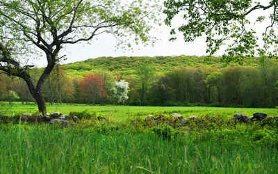
Much of Rhode Island is woodland; lowlands in the south and rolling hills in the north and the west.
Rhode Island Highest, Lowest, & Mean Elevations |
|
|---|---|
| Mean Elevation | 200 ft. |
| Highest Point | Jerimoth Hill 812 ft. |
| Lowest Point | Atlantic Ocean Sea level |
| Elevation | Sea level |
Rhode Island Land Area (Square Miles) |
|
| Geographic Center | In Kent County, 1 mi. SSW of Crompton Longitude: 71° 34.6'W Latidude: 41° 40.3'N |
| Total Area | 1,545.05 sq. mi. 50th |
| Land Area | 1,044.93 sq. mi. 77.64% |
| Water Area | 500.12 sq. mi. 32.36% |
| Forested Land Area | 61.1% |
| Dimensions (Length - Width) |
40 miles - 30 miles |
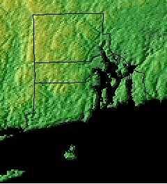
Rhode Island: Physiographic Regions
The state can be divided into two geographic regions;
- the Coastal Lowland in the south and east, and the
- Eastern New England Upland in the northwest.
Coastal Lowland
The Coastal Lowlands covers more than half of the mainland and the islands of Narragansett Bay. There are sandy beaches, salt ponds and lagoons west of Point Judith. Low, rounded slopes with few trees are to the east of Narragansett Bay. There are more rugged and forested woodlands to the west of Narragansett Bay.
Eastern New England Upland
Jerimoth Hill, the highest point in Rhode Island lies in the northwest corner of the state. This area is sometimes called the Western Rocky Upland because it is marked with rolling hills and higher elevations. This region rises from 200 feet above sea level ( east) to over 800 feet above sea level (northwest). There are many small lakes and ponds among the hills in this New England State.
Rhode Island Landscape and Landforms:
Southern New England
The Southern New England physiographic area covers parts of northern New Jersey, southern New York including Long Island, the majority of Connecticut, all of Rhode Island, most of eastern Massachusetts, the southeastern corner of New Hampshire, and south-coastal Maine. This area has experienced the greatest amount of urbanization of any part of the Northeast, including the entire Boston-to-New York City corridor. Urbanization and associated human activities severely threaten remaining high-priority habitats, especially maritime marshes and dunes, relict grasslands, and mature deciduous forests. Forest fragmentation, which is not a major issue in most parts of the Northeast, is a severe factor threatening forest bird populations. Currently, urban land covers roughly one-third of the physiographic area, with an additional 25 % of the region in agricultural production, primarily in the Connecticut River Valley, eastern Long Island, and northern New Jersey. Remaining forests are a mixture of oak-hickory and other hardwoods, white pine-red pine forest, and pine-oak woodlands or barrens.

