


Click Image to Enlarge
Iowa Counties
There are ninety-nine counties in Iowa. The first two counties, Des Moines County and Dubuque County, were created in 1834 when Iowa was still part of the Michigan Territory. In preparation for Michigan's statehood, part of Michigan Territory was formed into Wisconsin Territory in 1836]. Two years later, the western portion was split off to become Iowa Territory. The south-eastern part of Iowa Territory became Iowa, the 29th state in the union, on 28 December 1846, by which point 44 Counties had been created. Counties continued to be created by the state government until 1857, when the last county, Humboldt County, was created.Iowa Counties: History and Information
Focused on the histories of Iowa counties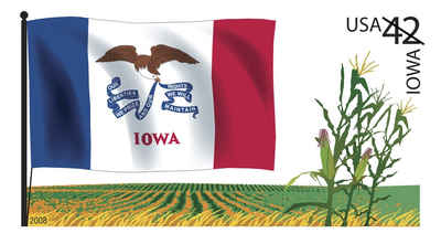
Iowa is a state in the Midwestern region of the United States of America. It is the 29th state of the United States, having joined the Union on December 28, 1846. The state is named for the Ioway people, a Siouan tribe of Native Americans that formerly lived there.
There are 99 counties in the state of Iowa. The first two counties, Des Moines County and Dubuque County, were created in 1834 when Iowa was still part of the Michigan Territory. In preparation for Michigan's statehood, part of Michigan Territory was formed into Wisconsin Territory in 1836. Two years later, the western portion was split off to become Iowa Territory. The south-eastern part of Iowa Territory became Iowa, the 29th state in the union, on 28 December 1846, by which point 44 counties had been created. Counties continued to be created by the state government until 1857, when the last county, Humboldt County, was created. One of the most significant days in Iowa county history was January 15, 1851, on which 49 counties were created.
| Focused on the histories of Iowa counties | ||||
|---|---|---|---|---|
| County | 2000 Population |
Square Miles |
County Seat | Created |
| Adair County | 8,243 | 569 | Greenfield | 1851 |
| Adams County | 4,482 | 424 | Corning | 1851 |
| Allamakee County | 14,675 | 640 | Waukon | 1847 |
| Appanoose County | 13,721 | 496 | Centerville | 1843 |
| Audubon County | 6,830 | 443 | Audubon | 1851 |
| Benton County | 25,308 | 716 | Vinton | 1837 |
| Black Hawk County | 128,012 | 567 | Waterloo | 1843 |
| Boone County | 26,224 | 572 | Boone | 1846 |
| Bremer County | 23,325 | 438 | Waverly | 1851 |
| Buchanan County | 21,093 | 571 | Independence | 1837 |
| Buena Vista County | 20,411 | 575 | Storm Lake | 1851 |
| Butler County | 15,305 | 580 | Allison | 1851 |
| Calhoun County | 11,115 | 570 | Rockwell City | 1851 |
| Carroll County | 21,421 | 569 | Carroll | 1851 |
| Cass County | 14,684 | 564 | Atlantic | 1851 |
| Cedar County | 18,187 | 580 | Tipton | 1837 |
| Cerro Gordo County | 46,447 | 568 | Mason City | 1851 |
| Cherokee County | 13,035 | 577 | Cherokee | 1851 |
| Chickasaw County | 13,095 | 505 | New Hampton | 1851 |
| Clarke County | 9,133 | 431 | Osceola | 1846 |
| Clay County | 17,372 | 569 | Spencer | 1851 |
| Clayton County | 18,678 | 779 | Elkader | 1837 |
| Clinton County | 50,149 | 695 | Clinton | 1837 |
| Crawford County | 16,942 | 714 | Denison | 1851 |
| Dallas County | 40,750 | 586 | Adel | 1846 |
| Davis County | 8,541 | 503 | Bloomfield | 1843 |
| Decatur County | 8,689 | 532 | Leon | 1846 |
| Delaware County | 18,404 | 578 | Manchester | 1837 |
| Des Moines County | 42,351 | 416 | Burlington | 1834 |
| Dickinson County | 16,424 | 381 | Spirit Lake | 1851 |
| Dubuque County | 89,143 | 608 | Dubuque | 1834 |
| Emmet County | 11,027 | 396 | Estherville | 1851 |
| Fayette County | 22,008 | 731 | West Union | 1837 |
| Floyd County | 16,900 | 501 | Charles City | 1851 |
| Franklin County | 10,704 | 582 | Hampton | 1851 |
| Fremont County | 8,010 | 511 | Sidney | 1847 |
| Greene County | 10,366 | 568 | Jefferson | 1851 |
| Grundy County | 12,369 | 503 | Grundy Center | 1851 |
| Guthrie County | 11,353 | 591 | Guthrie Center | 1851 |
| Hamilton County | 16,438 | 577 | Webster City | 1856 |
| Hancock County | 12,100 | 571 | Garner | 1851 |
| Hardin County | 18,812 | 569 | Eldora | 1851 |
| Harrison County | 15,666 | 697 | Logan | 1851 |
| Henry County | 20,336 | 434 | Mount Pleasant | 1836 |
| Howard County | 9,932 | 473 | Cresco | 1851 |
| Humboldt County | 10,381 | 434 | Dakota City | 1851 |
| Ida County | 7,837 | 432 | Ida Grove | 1851 |
| Iowa County | 15,671 | 586 | Marengo | 1843 |
| Jackson County | 20,296 | 636 | Maquoketa | 1837 |
| Jasper County | 37,213 | 730 | Newton | 1846 |
| Jefferson County | 16,181 | 435 | Fairfield | 1839 |
| Johnson County | 111,006 | 614 | Iowa City | 1837 |
| Jones County | 20,221 | 575 | Anamosa | 1837 |
| Keokuk County | 11,400 | 579 | Sigourney | 1837 |
| Kossuth County | 17,163 | 973 | Algona | 1851 |
| Lee County | 38,052 | 517 | Fort Madison | 1836 |
| Linn County | 191,701 | 718 | Cedar Rapids | 1837 |
| Louisa County | 12,183 | 402 | Wapello | 1836 |
| Lucas County | 9,422 | 431 | Chariton | 1846 |
| Lyon County | 11,763 | 588 | Rock Rapids | 1851 |
| Madison County | 14,019 | 561 | Winterset | 1844 |
| Mahaska County | 22,335 | 571 | Oskaloosa | 1843 |
| Marion County | 32,052 | 554 | Knoxville | 1845 |
| Marshall County | 39,311 | 572 | Marshalltown | 1846 |
| Mills County | 14,547 | 437 | Glenwood | 1851 |
| Mitchell County | 10,874 | 469 | Osage | 1851 |
| Monona County | 10,020 | 693 | Onawa | 1851 |
| Monroe County | 8,016 | 433 | Albia | 1843 |
| Montgomery County | 11,771 | 424 | Red Oak | 1851 |
| Muscatine County | 41,722 | 439 | Muscatine | 1836 |
| O'Brien County | 15,102 | 573 | Primghar | 1851 |
| Osceola County | 7,003 | 399 | Sibley | 1851 |
| Page County | 16,976 | 535 | Clarinda | 1847 |
| Palo Alto County | 10,147 | 564 | Emmetsburg | 1851 |
| Plymouth County | 24,849 | 864 | Le Mars | 1851 |
| Pocahontas County | 8,662 | 578 | Pocahontas | 1851 |
| Polk County | 374,601 | 570 | Des Moines | 1846 |
| Pottawattamie County | 87,704 | 954 | Council Bluffs | 1848 |
| Poweshiek County | 18,815 | 585 | Montezuma | 1843 |
| Ringgold County | 5,469 | 538 | Mount Ayr | 1855 |
| Sac County | 11,529 | 576 | Sac City | 1851 |
| Scott County | 158,668 | 458 | Davenport | 1837 |
| Shelby County | 13,173 | 591 | Harlan | 1851 |
| Sioux County | 31,589 | 768 | Orange City | 1851 |
| Story County | 79,981 | 573 | Nevada | 1846 |
| Tama County | 18,103 | 721 | Toledo | 1843 |
| Taylor County | 6,958 | 534 | Bedford | 1847 |
| Union County | 12,309 | 424 | Creston | 1851 |
| Van Buren County | 7,809 | 485 | Keosauqua | 1836 |
| Wapello County | 36,051 | 432 | Ottumwa | 1843 |
| Warren County | 40,671 | 572 | Indianola | 1846 |
| Washington County | 20,670 | 569 | Washington | 1837 |
| Wayne County | 6,730 | 526 | Corydon | 1846 |
| Webster County | 40,235 | 715 | Fort Dodge | 1853 |
| Winnebago County | 11,723 | 400 | Forest City | 1847 |
| Winneshiek County | 21,310 | 690 | Decorah | 1847 |
| Woodbury County | 103,877 | 873 | Sioux City | 1851 |
| Worth County | 7,909 | 400 | Northwood | 1851 |
| Wright County | 14,334 | 581 | Clarion | 1851 |

Click Image to Enlarge
