

Click Image to Enlarge
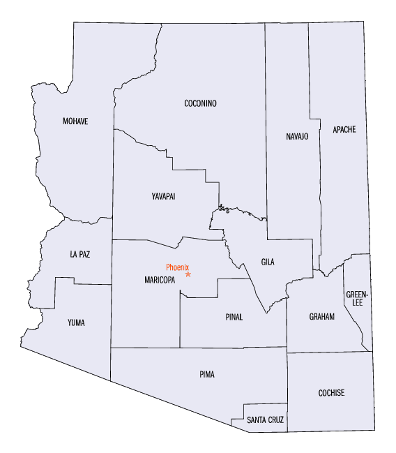
Arizona Counties
There are fifteen Counties in Arizona. There is one defunct county: Pah-Ute County formed in 1865 from Mohave County and returned in 1871. Four Counties (Mohave, Pima, Yavapai and Yuma) were created in 1864 following the organization of the Arizona Territory in 1862. The newest, La Paz County was created in 1983.Mohave County, Arizona
Mohave County Education, Geography, and History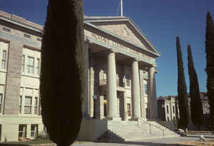
Mohave County is located in the northwestern corner of the state of Arizona. Based on the 2010 census, its population was 200,186. Mohave county was created in 1864. The county seat is Kingman, and the largest city is Lake Havasu City. Mohave county is named after the Mohave people. The word Mohave means "along the water," referring to the Colorado.
Mohave County comprises the Lake Havasu City-Kingman, AZ Metropolitan Statistical Area, which is also included in the Las Vegas-Henderson, NV-AZ Combined Statistical Area.
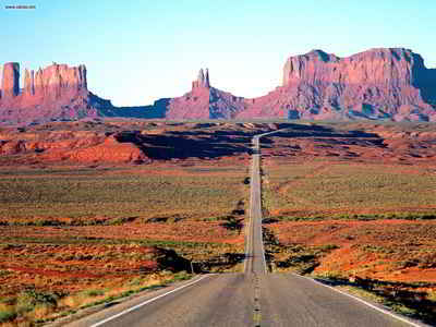
Mohave County contains parts of Grand Canyon National Park and Lake Mead National Recreation Area and all of the Grand Canyon-Parashant National Monument. The Kaibab, Fort Mojave and Hualapai Indian Reservations also lie within the county.
Etymology - Origin of Mohave County Name
Mohave is named after the Mohave Indians, one of the Yuma tribes.
Demographics:
County QuickFacts: CensusBureau Quick Facts
Mohave County History
Mohave County, Arizona
Mohave county is created out of the northwestern part of the Territory, and is surrounded on the west by the Colorado River. The remarks made of the river valley in Yuma County will apply to this county. The county lying east of the Colorado River is
normally rolling and hilly, covered with nutritious grasses and an abundance of wood and timber. Stock thrives the year through without prepared food. There is a free pasturage in this county alone, yet
uninhabited, for enormous herds, and many valleys of exceptional agricultural lands.
It has been known since the society of the Territory, that nearly all the mountains in this county contained lodes of gold, silver, copper and lead, and, in 1863, an attempt was made to developed and work some of these lodes; some machinery was erected and considerable money expended, but as has been the case in nearly all new mining counties, hostility of Indians, extravagance, want of experience, etc., the investments proved disastrous, and the mining interest has been paralyzed, until within the past few months. Recently a few practical miners undertook the task of giving new life to this abandoned and almost forgotten field. Upon development, a number of lodes of gold and silver have been found, rich and extensive. A population of about five hundred miners has already accumulated in the Wallapai mining district. Machinery is being erected, roads built, and mines developed with a good prospect of excellent returns.
The inhabited places of the county are Mohave City, located on the Colorado River; Hardyville, six miles above, and the Wallapai mining district.
All merchandise are principally shipped tip the Colorado River, and landed either at Mohave or Hardyville, although wagon trains are constantly running from Los Angeles with goods for this section and the interior.
Geography: Land and Water
As reported by the Census Bureau, the county has a total area of 13,461 square miles (34,860 km2), of which 13,311 square miles (34,480
km2) is land and 150 square miles (390 km2) (1.1%) is water. It is the second-largest county by area in Arizona and the fifth-largest in the
Contiguous United States.
The county is made of two sections divided by the Grand Canyon, with no direct land communication between them. The northern section, smaller
and less populated, forms the western part of the Arizona Strip, bordering Utah and Nevada. The larger southern section, borders Nevada and
California across the Colorado River, which forms most of the county's western boundary. The southern section includes Kingman, the county
seat, and other cities, as well as part of the Mojave Desert.
Neighboring Counties
Bordering counties are as follows:
- North: Washington County, Utah
- Northeast: Kane County, Utah
- East: Coconino County
- Southeast: Yavapai County
- South: La Paz County
- Southwest: San Bernardino County, Calif.
- Northwest: Clark County, Nev.; Lincoln County, Nev.
Education
The following school districts and colleges serve Mohave County
Unified school districts
- Colorado City Unified School District
- Kingman Unified School District
- Lake Havasu Unified School District
- Littlefield Unified School District
- Peach Springs Unified School District
- Kingman Academy of Learning
High school districts
- Colorado River Union High School District
Elementary school districts
- Bullhead City Elementary School District
- Hackberry School District
- Mohave Valley Elementary School District
- Owens-Whitney Elementary School District
- Topock Elementary School District
- Valentine Elementary School District
- Yucca Elementary School District
Colleges
- Mohave Community College


Click Image to Enlarge
