

Click Image to Enlarge
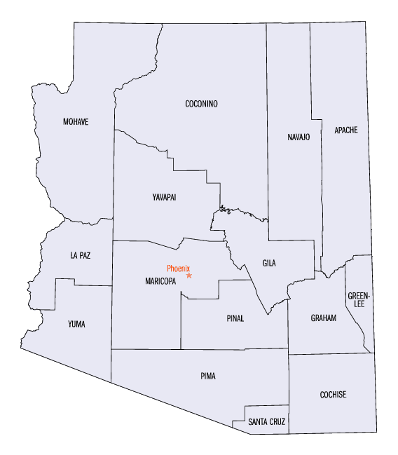
Arizona Counties
There are fifteen Counties in Arizona. There is one defunct county: Pah-Ute County formed in 1865 from Mohave County and returned in 1871. Four Counties (Mohave, Pima, Yavapai and Yuma) were created in 1864 following the organization of the Arizona Territory in 1862. The newest, La Paz County was created in 1983.Pinal County, Arizona
Pinal County Education, Geography, and History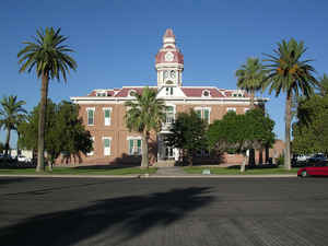
Pinal County is a county located in the central part of the state of Arizona. Based on the 2010 census, the
population was 375,770,
making it the third-most populous county in Arizona. The county
seat is Florence. The county was founded in 1875.
The county was named after the Pinal Mountains (named
from the Spanish for stand of pines) and the Pinal Indian people (a band
of Coyotero Apaches) who lived there.
Pinal County contains parts of the Tohono O'odham Nation, the Gila River Indian Community and the San Carlos Apache Indian Reservation, as
well as the entirety of the Ak-Chin Indian Community.
Pinal County is included in the Phoenix-Mesa-Scottsdale, AZ Metropolitan Statistical Area.
Etymology - Origin of Pinal County Name
Pinal County name may have been derived from that of the Pinal Apaches or maybe from the pine groves in the lofty mountains.
Demographics:
County QuickFacts: CensusBureau Quick Facts
Pinal County History
Pinal County, Arizona
Pinal County experienced slight modifications in 1877 to correct a boundary error, and it also lost the Globe District of southern Gila in 1881. Its present area is 3,441,920 acres. Included in it are the Gila River (forming part of its boundary) and part of the San Carlos Indian Reservation. Pinal County varies in its characteristics from the agricultural land around its county seat at Florence to the mountains where many rich mining discoveries have been made.
In 1871, the Territorial Legislature designated 5,324 miles of some of Arizona's prime land as Pinal County. Pinal County was formed out of portions of Maricopa and Pima Counties on February 1, 1875. Florence, Arizona was established in 1866, was designated as, and has remained, the County seat. Arizona became a state in 1912. It has flown the flags of Spain, Mexico, the Confederacy and the Union. It derives its name from the Pinal Apaches or "pine groves in the mountains." There are four Indian Nations - the Maricopa-Pima (Ak-Chin), Gila River, Tohono O'Odham and San Carlos Apache in Pinal County. They occupy twenty-three percent of the counties.
This area which housed America's first civilization, the capitol of the Toltecs, the Walled Cities of the Aztecs, the father of American irrigation, and the friendly Pima Indians now has vast farming areas and grows such things as cotton, vegetables, and fruit. A lot of migrant workers made their homes in Pinal County. Also, Pinal County had a lot of copper mining but most of the mines have closed now. These mines brought in a lot of workers in the early 1920's.
Geography: Land and Water
As reported by the Census Bureau, the county has a total area of 5,374 square miles (13,920 km2), of which 5,366 square miles (13,900 km2) is land and 8.6 square miles (22 km2) (0.2%) is water.
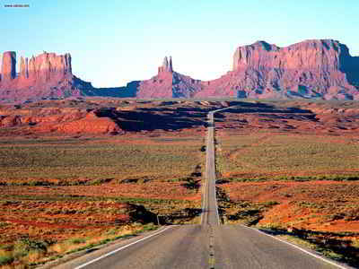
The Superstition Mountains climb in northern Pinal County east of Phoenix, and the county is also home to Boyce Thompson Arboretum, Casa Grande Ruins National Monument and Picacho Peak State Park. You can explore much of the county on the Pinal Pioneer Parkway (State Route 79).
Neighboring Counties
Bordering counties are as follows:
- Northeast: Gila County
- East: Graham County
- Southwest: Pima County
- Northwest: Maricopa County
Education


Click Image to Enlarge
