


Click Image to Enlarge
Idaho Counties
There are forty-four Counties in Idaho. When Idaho became a territory in March, 1863, there were four Counties in existence: Boise, Idaho, Nez Perce and Shoshone. By the time Idaho became a state, there were 15 counties. The rest of the 44 Counties came into existence during the 30 years after Idaho became a state. Two of the former counties disappeared during this time. Alturas, which was created in 1864, was later divided into the many counties now found in central Idaho. Logan County was only in existence for six years, from 1889 to 1895. It was combined with Alturas to form Blaine County and Lincoln County, which was formed just two weeks after Logan lost its identity.Boise County, Idaho
Boise County Education, Geography, and History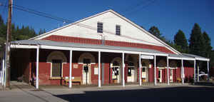
Boise County is a rural mountain county in the state of Idaho. Based on the 2010 census, the
population was 7,028. Boise County was created
on February 4, 1864. The county seat is
Idaho City, and Horseshoe Bend is its largest city. Boise county is
named for the Boise River.
Boise County is part of the Boise, ID Metropolitan Statistical Area.
The Bogus Basin ski area is in the southwestern part of the county. The county's eastern area contains the central section of the Sawtooth
Wilderness, the western part of the Sawtooth National Recreation Area.
Etymology - Origin of Boise County Name
Boise County is named for the Boise River, which empties into the Snake River in western Canyon County. Boise is French for wooded.
Demographics:
County QuickFacts: CensusBureau Quick Facts
Boise County History
Established February 4, 1864 with its county seat at Idaho City. Named for the Boise River, which was named by French-Canadian explorers and trappers for the great variety of trees growing along its banks. The Boise Basin, in which Idaho City lies, was one of the richest gold mining districts in the nation after the discovery of gold in 1862. At its peak in the 1860s and 1870s, Idaho City was, for a time, the largest city in the northwest, it was this great influx of people that lead to the establishment of the Idaho Territory.
Geography: Land and Water
As reported by the Census Bureau, the county has a total area of 1,907 square miles (4,940 km2), of which 1,899 square miles (4,920 km2) is land and 7.4 square miles (19 km2) (0.4%) is water.
Boise county is located close to the center of Idaho. The highest point in the county is Thompson Peak at 10,751 feet (3,277 m), on its eastern border in the Sawtooth Wilderness. The county's lowest point is on the Payette River, on its western border with Gem County, at approximately 2,500 feet (762 m).
Neighboring Counties
Bordering counties are as follows:
- North: Valley County
- East: Custer County
- Southeast: Elmore County
- Southwest: Ada County
- West: Gem County
Education


Click Image to Enlarge
