


Click Image to Enlarge
Idaho Counties
There are forty-four Counties in Idaho. When Idaho became a territory in March, 1863, there were four Counties in existence: Boise, Idaho, Nez Perce and Shoshone. By the time Idaho became a state, there were 15 counties. The rest of the 44 Counties came into existence during the 30 years after Idaho became a state. Two of the former counties disappeared during this time. Alturas, which was created in 1864, was later divided into the many counties now found in central Idaho. Logan County was only in existence for six years, from 1889 to 1895. It was combined with Alturas to form Blaine County and Lincoln County, which was formed just two weeks after Logan lost its identity.Bonneville County, Idaho
Bonneville County Education, Geography, and History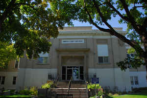
Bonneville County is a county located in the state of Idaho. Based on the 2010 census, the county had a
population of 104,234, making it
the fourth-most populous county in Idaho and the most populous in eastern Idaho.
Bonneville County was created in 1911. The county
seat and largest city is Idaho Falls. Bonneville is
named after Benjamin Bonneville (1796-1878), a French-born officer in the US Army, fur trapper, and
explorer in the American West.
Bonneville County is part of the Idaho Falls, ID Metropolitan Statistical Area.
Etymology - Origin of Bonneville County Name
Bonneville County is named for Captain Benjamin Louis Eulalie de Bonneville, a French-born United States Army officer who explored the area in the 1830s.
Demographics:
County QuickFacts: CensusBureau Quick Facts
Bonneville County History
Established February 7, 1911 by the state legislature from the north and east parts of Bingham County. Named for Captain B. L. E. Bonneville, of the U. S. Army, who explored throughout the Snake River area in the 1830s. A settlement developed at the site of 1864, this settlement was known as Idaho Falls after 1891.
Geography: Land and Water
As reported by the Census Bureau, the county has a total area of 1,901 square miles (4,920 km2), of which 1,866 square miles (4,830 km2) is land and 35 square miles (91 km2) (1.8%) is water.
Bonneville county is located in east Idaho. The Snake River flows northwest through the Bonneville County, beginning at the Wyoming border as the Palisades Reservoir. The river exits the county about midway on its northern border, turns and re-enters approximately 20 miles (32 km) west to flow southwest through Idaho Falls .
Neighboring Counties
Bordering counties are as follows:
- North: Jefferson County; Madison County; Teton County
- East: Teton County, Wyo.; Lincoln County, Wyo.
- South: Caribou County
- Southwest: Bingham County
Education


Click Image to Enlarge
