


Click Image to Enlarge
Idaho Counties
There are forty-four Counties in Idaho. When Idaho became a territory in March, 1863, there were four Counties in existence: Boise, Idaho, Nez Perce and Shoshone. By the time Idaho became a state, there were 15 counties. The rest of the 44 Counties came into existence during the 30 years after Idaho became a state. Two of the former counties disappeared during this time. Alturas, which was created in 1864, was later divided into the many counties now found in central Idaho. Logan County was only in existence for six years, from 1889 to 1895. It was combined with Alturas to form Blaine County and Lincoln County, which was formed just two weeks after Logan lost its identity.Latah County, Idaho
Latah County Education, Geography, and History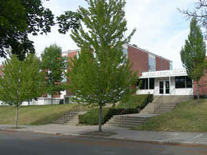
Latah County is a county located in the north central region of the state of Idaho. Based on the 2010 census, the
population was 37,244. The county was
created in 1888. The county seat
and largest city is Moscow. Latah is named for Latah Creek in its northwest corner. The name is Nez Perce and means "the place of
pine trees and pestle," because the tribe found stones here suitable for pulverizing camas roots and shade under the white pine trees in which
to work.
Latah County comprises the Moscow, ID Micropolitan Statistical Area, which is included in the Pullman-Moscow, WA-ID Combined Statistical Area.
Etymology - Origin of Latah County Name
Latah County is named for Latah Creek, which in turn is named for a Nez Perce term for "the place of pine trees and pestle." An earlier county was named Lah-Toh County.
Demographics:
County QuickFacts: CensusBureau Quick Facts
Latah County History
Established May 14, 1888 with its county seat at Moscow. This area was first formed as Lah-Toh County in 1864 with Coeur d'Alene as the county seat, in 1867 the name Lah-Toh was dropped when the area was placed in Nez Perce County. In 1888 the U. S. Congress created the county as we know it, the 16th Idaho county and the only Idaho county created by Congress. Named for Latah Creek, which drains the northwest corner. The name is Nez Perce and means "the place of pine trees and pestle," because the Indians found stones here suitable for pulverizing camas roots and shade under the pine trees in which to work.
Geography: Land and Water
As reported by the Census Bureau, the county has a total area of 1,077 square miles (2,790 km2), of which 1,076 square miles (2,790 km2) is land and 0.9 square miles (2.3 km2) (0.09%) is water.
Latah county is located in northwest Idaho. The county is part of the Palouse, a wide and rolling portion of the middle Columbia basin.
Neighboring Counties
Bordering counties are as follows:
- North: Benewah County
- Northeast: Shoshone County
- East: Clearwater County
- South: Nez Perce County
- West: Whitman County, Wash.
Education


Click Image to Enlarge
