


Click Image to Enlarge
Idaho Counties
There are forty-four Counties in Idaho. When Idaho became a territory in March, 1863, there were four Counties in existence: Boise, Idaho, Nez Perce and Shoshone. By the time Idaho became a state, there were 15 counties. The rest of the 44 Counties came into existence during the 30 years after Idaho became a state. Two of the former counties disappeared during this time. Alturas, which was created in 1864, was later divided into the many counties now found in central Idaho. Logan County was only in existence for six years, from 1889 to 1895. It was combined with Alturas to form Blaine County and Lincoln County, which was formed just two weeks after Logan lost its identity.Lemhi County, Idaho
Lemhi County Education, Geography, and History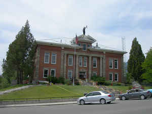
Lemhi County is a county located in the state of Idaho. Based on the 2010 census, the population was 7,936. The county was created in 1869. The largest city and county seat is Salmon. Lemhi county is named after Fort Lemhi (or Limhi), a remote Mormon missionary settlement from 1855-1858 in Bannock and Shoshone territory.
Etymology - Origin of Lemhi County Name
Lemhi County is named for Fort Lemhi, a local mission and fort of the Church of Jesus Christ of Latter-Day Saints, which in turn was named for King Lemhi, a figure in the Book of Mormon.
Demographics:
County QuickFacts: CensusBureau Quick Facts
Lemhi County History
Established January 9, 1869 with its county seat at Salmon. Named for Fort Lemhi, the L.D.S. Salmon River Mission, which was named for King Lemhi in the book of Mormon. Lewis and Clark were the first white men in this area.
Geography: Land and Water
As reported by the Census Bureau, the county has a total area of 4,569 square miles (11,830 km2), of which 4,563 square miles (11,820 km2) is land and 5.4 square miles (14 km2) (0.1%) is water.
Lemhi county is located close to the center of Idaho. The county is the fourth-largest county in Idaho by area. The highest point is Bell Mountain at 11,612 ft (3,539 m) above sea level, and the lowest point is the Salmon River as it exits on the county's western border with Idaho County at approximately 3,000 feet (914 m). The river cuts through the center of Lemhi County before turning west. The county's eastern border with Beaverhead County, Montana, is the continental divide.
Neighboring Counties
Bordering counties are as follows:
- North: Ravalli County, Mont.
- East: Beaverhead County, Mont.
- Southeast: Clark County; Butte County
- Southwest: Custer County
- West: Valley County
- Northwest: Idaho County
Education


Click Image to Enlarge
