

Click Image to Enlarge
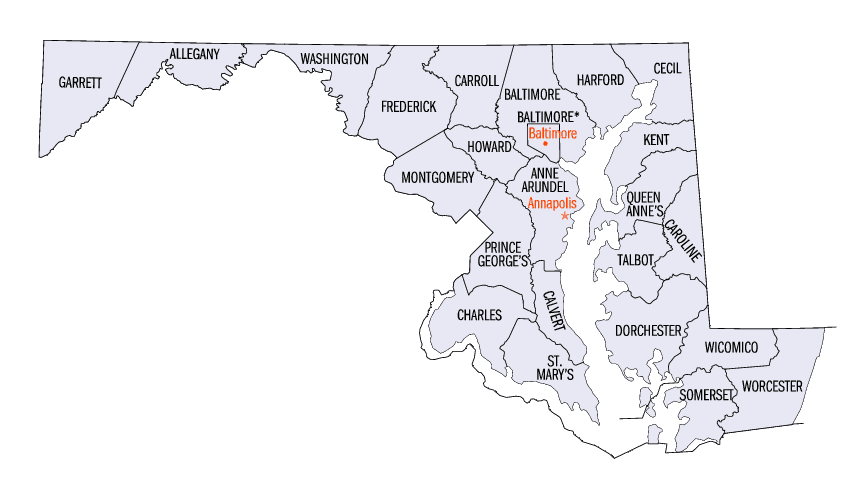
Maryland Counties
There are twenty-four counties and county-equivalents in Maryland. Though an independent city rather than a county, the City of Baltimore is considered the equal of a county. The last new county formation in Maryland occurred when Garrett County was formed in 1872 from portions of Allegany County.Carroll County, Maryland
Carroll County Education, Geography, and History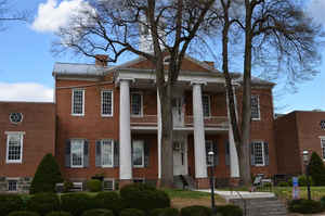
Carroll County is a county located in the state of Maryland. Based on the 2010 census, the population was 167,134. Its county seat is
Westminster.
Carroll County is included in the Baltimore-Columbia-Towson, MD Metropolitan Statistical Area, which is also included in the
Washington-Baltimore-Arlington, DC-MD-VA-WV-PA Combined Statistical Area.
Etymology - Origin of Carroll County Name
Charles Carroll of Carrollton, a representative to the Continental Congress and signatory of the Declaration of Independence
Demographics:
County QuickFacts: CensusBureau Quick Facts
Carroll County History
Carroll County was created in 1837 from parts of Baltimore and Frederick Counties, see Hundred (division). It was named for Charles Carroll
of Carrollton (1737-1832), signer of the American Declaration of Independence.
During the American Civil War, the population of Carroll County was sharply divided between supporters of the Union and the Confederacy. In
1863, there were significant troop movements through the county as part of the Gettysburg campaign. On June 29, 1863, the cavalry skirmish
known as Corbit's Charge was fought in the streets of Westminster, when two companies of Delaware cavalry attacked a much larger Confederate
force under General J.E.B. Stuart.
In 2013 the Carroll County Board of Commissioners voted to make English the official language of the county.
Geography: Land and Water
As reported by the Census Bureau, the county has a total area of 453 square miles (1,170 km2), of which 448 square miles (1,160 km2) is
land and 5.1 square miles (13 km2) (1.1%) is water.
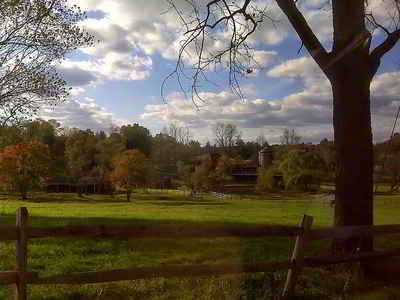
Topographically, Carroll County is located within the Piedmont Plateau region, with characteristic upland terrain of rolling hills and
deciduous forest. The most prominent relief is Parr's Ridge, which bisects the county from southwest to northeast. The highest point is in the
northeastern part of the county on Dug Hill along Deep Run Road.
Carroll County is bordered on the north by the Mason - Dixon line with Pennsylvania, and on the south by Howard County across the South Branch
of the Patapsco River. About half of the eastern border, with Baltimore County, is formed by the North Branch of the Patapsco River and by
Liberty Reservoir, though the northern half near Manchester and Hampstead is a land border. Carroll County is bordered on the west by
Frederick County, across the Monocacy River and Sam's Creek. Other major streams in the county include Big Pipe Creek, Little Pipe Creek, and
Double Pipe Creek, Bear Branch, and the headwaters of the Gunpowder Falls. The Piney Run Reservoir is in the southern part of the county.
Three railroad lines cross Carroll County. The old Baltimore and Ohio (B&O) Old Main Line crosses the southern part of the county from east to
west, with former stations in Sykesville and Mount Airy. The original Western Maryland Railway (WM) main line track runs southeast to
northwest through Carrollton, Westminster, New Windsor, and Union Bridge. The old Baltimore and Hanover Railroad (later acquired by WM) runs
further to the east through Hampstead, Millers, and Lineboro. Two of these railroad lines are now operated by CSX Transportation; the former
WM main line is now operated by Maryland Midland Railway.
Neighboring Counties
Bordering counties are as follows:
- Northeast: York County, Pa.
- Southeast: Baltimore County
- South: Howard County
- Southwest: Montgomery County; Frederick County
- Northwest: Adams County, Pa.
Education
The Carroll County Public Schools School system is the ninth largest school district in the state of Maryland.
McDaniel College, a small private liberal arts college, is located in Westminster.


Click Image to Enlarge
