


Click Image to Enlarge
Montana Counties
There are fifty-six counties in Montana. Montana has two consolidated city-counties- Anaconda with Deer Lodge County and Butte with Silver Bow County. The portion of Yellowstone National Park that lies within Montana was not part of any county until 1997, when part of it was nominally added to Gallatin County, and the rest of it to Park County.Beaverhead County, Montana
Beaverhead County Education, Geography, and History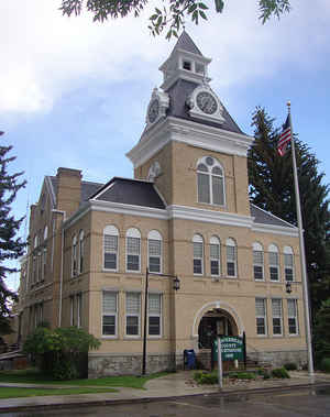
Beaverhead County is the largest county by area in the state of Montana. Based on the 2010 census, the population was 9,246. Its county
seat is Dillon. The county was founded in 1865.
Much of the perimeter of the county is the Continental Divide, including all of its border with the state of Idaho. The divide heads east into
Montana at the county border with Ravalli County, between Lost Trail Pass and Chief Joseph Pass.
Etymology - Origin of Beaverhead County Name
The Beaverhead Rock in the Jefferson River, which is shaped like a beaver's head
Demographics:
County QuickFacts: CensusBureau Quick Facts
Beaverhead County History
Beaverhead County was created 2 February 1865 as an original county. County seat: Dillon
Beaverhead County, in the Southwestern corner of the state, was organized as one of the original territorial counties on February 2, 1865. It was named for the rock which Sacajawea pointed out to Lewis and Clark explaining that her people had called it that because it resembled a beaver's head . It was one of the smallest of the original counties, but is now one of the largest. Beaverhead County maintained its original area throughout all the county dividing and the only change in its borders was made by an annexation of a part of Madison County in 1911. It contains Montana's oldest town, Bannack City, where a post office was established in November 1863. Dillon is the county seat.
From Names on the Faces of Montana
by Roberta Carkeek Cheney
Copyright 1983 Revised 1984
6th printing, January 1996
Geography: Land and Water
As reported by the Census Bureau, the county has a total area of 5,572 square miles (14,432 km2), of which,
5,542 square miles (14,355 km2) of it is land and 30 square miles (77 km2) of it (0.53%) is water.
Beaverhead County is the largest county by area in the state of Montana, located in the southwest corner of Montana and surrounded on three sides by the Continental Divide, is the largest county in Montana. It's land area consists of deep basins separated by towering mountain ranges.
Neighboring Counties
Bordering counties are as follows:
- Ravalli County, Montana - northwest
- Deer Lodge County, Montana - north
- Silver Bow County, Montana - north
- Madison County, Montana - east
- Fremont County, Idaho - southeast
- Clark County, Idaho - south
- Lemhi County, Idaho - west
Education


Click Image to Enlarge
