


Click Image to Enlarge
Montana Counties
There are fifty-six counties in Montana. Montana has two consolidated city-counties- Anaconda with Deer Lodge County and Butte with Silver Bow County. The portion of Yellowstone National Park that lies within Montana was not part of any county until 1997, when part of it was nominally added to Gallatin County, and the rest of it to Park County.Silver Bow County, Montana
Silver Bow County Education, Geography, and History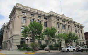
Silver Bow County is a county located in the State of Montana. Based on the 2010 census, the population was 34,200. Its county seat is Butte.
In 1977, the city and county governments consolidated to form the single entity of Butte-Silver Bow. Additionally, the town of Walkerville is
a separate municipality from Butte and is located within the county.
Silver Bow County comprises the Butte-Silver Bow, MT Micropolitan Statistical Area.
Etymology - Origin of Silver Bow County Name
Silver Bow Creek. There are multiple theories explaining how the creek got its name
Demographics:
County QuickFacts: CensusBureau Quick Facts
Silver Bow County History
Silver Bow County was created 16 February 1881 from Deer Lodge County. County seat: Butte
Geography: Land and Water
As reported by the Census Bureau, the county has a total area of 719 square miles (1,862 km2), of which, 718
square miles (1,860 km2) of it is land and 1 square miles (2 km2) of it (0.09%) is water. In area, it is the
smallest county in Montana.
Neighboring Counties
Bordering counties are as follows:
- Deer Lodge County, Montana - northwest & west
- Jefferson County, Montana - east
- Madison County, Montana - south
- Beaverhead County, Montana - southwest
Education


Click Image to Enlarge
