


Click Image to Enlarge
Montana Counties
There are fifty-six counties in Montana. Montana has two consolidated city-counties- Anaconda with Deer Lodge County and Butte with Silver Bow County. The portion of Yellowstone National Park that lies within Montana was not part of any county until 1997, when part of it was nominally added to Gallatin County, and the rest of it to Park County.Daniels County, Montana
Daniels County Education, Geography, and History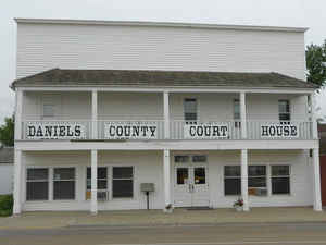
Daniels County is a county located in the state of Montana. Based
on the 2010 census, the population was 1,751. Its county seat is Scobey.
As of 2000, Daniels County was considered the most rural county in the
continental United States as measured by the Index of Relative Rurality.
It is south from the Canadian border of Saskatchewan.
Etymology - Origin of Daniels County Name
Mansfield A. Daniels, an early rancher and storekeeper
Demographics:
County QuickFacts: CensusBureau Quick Facts
Daniels County History
Daniels County was created 30 August 1920 from Valley and Sheridan Counties. County seat: Scobey. The name comes from Mansfield Daniels, a local rancher.
Geography: Land and Water
As reported by the Census Bureau, the county has a total area of 1,427
square miles (3,695 km2). 1,426 square miles (3,694 km2)
of it is land and 1 km2 (less then 1 sq mi) of it (0.03%)
is water.
Neighboring Counties
Bordering counties are as follows:
- Valley County, Montana - west
- Roosevelt County, Montana - south
- Sheridan County, Montana - east
- Old Post No. 43, Saskatchewan - northwest
- Poplar Valley No. 12, Saskatchewan - north
- Hart Butte No. 11, Saskatchewan - north
- Happy Valley No. 10, Saskatchewan - northeast
Education
There is one K-12 school serving all of Daniels County, Scobey High School


Click Image to Enlarge
