


Click Image to Enlarge
Montana Counties
There are fifty-six counties in Montana. Montana has two consolidated city-counties- Anaconda with Deer Lodge County and Butte with Silver Bow County. The portion of Yellowstone National Park that lies within Montana was not part of any county until 1997, when part of it was nominally added to Gallatin County, and the rest of it to Park County.Flathead County, Montana
Flathead County Education, Geography, and History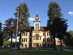
Flathead County is a county located in the state of Montana. Based on the 2010 census, the population was 90,928, making it the
third-most populous county in Montana. Its county seat is Kalispell. The numerical designation for Flathead County (used in the issuance of
license plates) is 7. It is south from the Canadian border of British Columbia.
Flathead County comprises the Kalispell, Montana Micropolitan Statistical Area.
Etymology - Origin of Flathead County Name
It was named for the Salish (Flathead) Indians. The name originated with the early settlers who called several different tribes of Indians by this name on account of their custom of flattening the heads of infants by fastening a piece of board or a pad of grass upon the forehead. After this had been worn several months it caused a flat appearance of the head.
Demographics:
County QuickFacts: CensusBureau Quick Facts
Flathead County History
Flathead County was created 6 February 1893 from Missoula County. County seat: Kalispell. It was named for the Salish (Flathead) Indians
Geography: Land and Water
As reported by the Census Bureau, the county has a total area of 5,256 square miles (13,614 km2), of which,
5,098 square miles (13,205 km2) of it is land and 158 square miles (410 km2) of it (3.01%) is water. The western
part of Glacier National Park is located in the county.
Neighboring Counties
Bordering counties are as follows:
- Lincoln County, Montana - west
- Sanders County, Montana - southwest
- Lake County, Montana - south
- Missoula County, Montana - southeast
- Powell County, Montana - southeast
- Lewis and Clark County, Montana - southeast
- Teton County, Montana - east
- Pondera County, Montana - east
- Glacier County, Montana - east
- Regional District of East Kootenay, British Columbia - north
Education


Click Image to Enlarge
