


Montana Counties

Click Image to Enlarge
Montana Counties
There are fifty-six counties in Montana. Montana has two consolidated city-counties- Anaconda with Deer Lodge County and Butte with Silver Bow County. The portion of Yellowstone National Park that lies within Montana was not part of any county until 1997, when part of it was nominally added to Gallatin County, and the rest of it to Park County.Liberty County, Montana
Liberty County Education, Geography, and History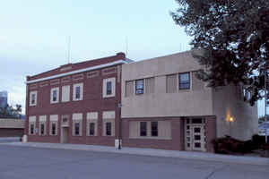
Liberty County is a county located in the state of Montana. Based on the 2010 census, the population was 2,339. Its county seat is Chester. The county was established in 1919
Etymology - Origin of Liberty County Name
The sentiment of the inhabitants when the county was formed soon after World War I
Demographics:
County QuickFacts: CensusBureau Quick Facts
Liberty County History
Liberty County was created 11 February 1920 from Chouteau and Hill Counties. County seat: Chester
Geography: Land and Water
As reported by the Census Bureau, the county has a total area of 1,447 square miles (3,748 km2), of which,
1,430 square miles (3,703 km2) of it is land and 17 square miles (45 km2) of it (1.21%) is water.
Neighboring Counties
Bordering counties are as follows:
- Toole County, Montana - west
- Pondera County, Montana - southwest
- Chouteau County, Montana - south
- Hill County, Montana - east
- Forty Mile County No. 8, Alberta - north
Education
Compare More Colleges and Universities

County Resources

Click Image to Enlarge

Search
© Copyright 2004-2024, eRD (eReferenceDesk.com) owned and operated by Joseph L Ferguson. All rights reserved.