


Montana Counties

Click Image to Enlarge
Montana Counties
There are fifty-six counties in Montana. Montana has two consolidated city-counties- Anaconda with Deer Lodge County and Butte with Silver Bow County. The portion of Yellowstone National Park that lies within Montana was not part of any county until 1997, when part of it was nominally added to Gallatin County, and the rest of it to Park County.Musselshell County, Montana
Musselshell County Education, Geography, and History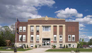
Musselshell County is a county located in the state of Montana. Based on the 2010 census, the population was 4,538. Its county seat is Roundup
Etymology - Origin of County Name
The Musselshell River, named in turn by the Lewis and Clark Expedition presumably due to mussels found on its banks
Demographics:
County QuickFacts: CensusBureau Quick Facts
Musselshell County History
Musselshell County was created 11 February 1911 from Fergus and Yellowstone Counties. County seat: Roundup
Geography: Land and Water
As reported by the Census Bureau, the county has a total area of 1,871 square miles (4,846 km2), of which,
1,867 square miles (4,836 km2) of it is land and 4 square miles (10 km2) of it is water. The total area is 0.20%
water.
Neighboring Counties
Bordering counties are as follows:
- Fergus County, Montana - northwest
- Petroleum County, Montana - north
- Rosebud County, Montana - east
- Yellowstone County, Montana - south
- Golden Valley County, Montana - west
Education
Compare More Colleges and Universities

County Resources

Click Image to Enlarge

Search
© Copyright 2004-2024, eRD (eReferenceDesk.com) owned and operated by Joseph L Ferguson. All rights reserved.