


Click Image to Enlarge
Montana Counties
There are fifty-six counties in Montana. Montana has two consolidated city-counties- Anaconda with Deer Lodge County and Butte with Silver Bow County. The portion of Yellowstone National Park that lies within Montana was not part of any county until 1997, when part of it was nominally added to Gallatin County, and the rest of it to Park County.Petroleum County, Montana
Petroleum County Education, Geography, and History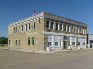
Petroleum County is a county located in the state of Montana. Based on the 2010 census, the population was 494, making it the least populous county in Montana and the seventh-least populous in the United States. Its county seat is Winnett. The Montana Legislature approved the formation of the county by separating it from Fergus County; Petroleum County was thus created on February 25, 1925, as the last of Montana's 56 counties
Etymology - Origin of Petroleum County Name
The production of petroleum at Cat Creek
Demographics:
County QuickFacts: CensusBureau Quick Facts
Petroleum County History
Petroleum County was created 24 November 1924 from Fergus and Garfield Counties. County seat: Winnett
The county' eastern boundary is formed by the Musselshell River. The Native Americans living in the area then were the Crow, Blackfoot, Nez Perce, and Sioux, all hunter gatherers. In 1868, a trading post was established at the mouth of this river and was named Musselshell. The seat of the country, at the center of the county, Winnett, was named for Walter John Winnett, a Canadian rancher who was captured by Sioux and later adopted into the tribe; he was given the name Eagle Eyes because of his remarkable shooting skills. Winnett established a ranch in Montana Territory in 1879 near an active trading post and the Hangman's Tree used by vigilantes in the area. The massive ranch house, which he built in 1900, housed his own family and served as a gathering place for the community. Winnett built up a freight line business to haul supplies from Billings. In 1910, he built a store and petitioned for a post office - and with that, Winnett became an official town. Fort Magginis was built in 1880 and thereafter, live stock farming proliferated. At that time, gold was also found in Fergus County, which was the original county from which Petroleum County was carved out. During the period from 1911 to 1915, stakes in the county were claimed by an influx of settlers with claims limited to 320 acres (130 ha) of land to each settler and squatter. However, in 1930 many of these lands reverted to the Government as settlers deserted the town
Geography: Land and Water
As reported by the Census Bureau, the county has a total area of 1,674 square miles (4,336 km2), of which, 1,654 square miles (4,284 km2) of it is land and 20 square miles (52 km2) of it (1.20%) is water.
Its land topography lies in an elevation range of 2,250 - 4,000 feet (690 - 1,220 m). The land lies in the Missouri Plateau section of
the Great Plains. The uplands are generally of fairly level land and valleys while the general topography is of rolling hills and valleys
except for sharp gullies on the side slopes of Missouri and Musselshell Rivers in certain stretches. The southern part of the county also
consists of moderate hill slopes and gentle valleys, interspersed with steep cliffs in some stretches.
Petroleum County is bordered to the north by Phillips County, Garfield County to the east, Rosebud County to the southeast, Musselshell County
to the south, and Fergus County to the west. Notable towns in the county include Winnett, Cat Creek, Flatwillow, Kelley, and Teigen. State
Highway 200 passes through the middle of county, State Highway 244 from the east end is from Winnet to the county, US Route 87 passes
through the southwest corner of the county. There is also a network of internal roads that connect to various places in the county. A
Tyrannosauridae fossil skeleton was discovered in the Judith River Formation, while Alamosaurus was discovered in the Hell Creek Formation.
Left: Missouri River, Charles M. Russell National Wildlife Refuge. Right: Fort Peck Dam on Missouri River in Fort Peck, Montana
Rivers running through the county include the Missouri River and Musselshell River. The Musselshell River is drained mostly by its tributaries
within the county. However, the northern tributaries drain into the Missouri River and eventually into the Fort Peck Reservoir. The creeks
which flow through the county are all ephemeral in nature, flowing only during the rainy season, while the larger creeks have formed flood
plains which are composed mainly of silt, clay and to some extent sand and pebbles. There are several creeks, including Bender Creek, Bear
Creek, and the other creeks are the Flat Willow Creek, Bender Creek, Box Elder Creek, Brickyard Creek, Buffalo Creek, Cat Creek, Cottonwood
Creek, Sacagawea River, and Dovetail Creek. Wild Horse Lake is located in the county formed in a natural depression. Some of the important
lakes and reservoirs in the county are: Little Bear Lake, Wild Horse Lake, War Horse Lake, Petrolia Lake, War Horse Lake, Yellow Water
Reservoir and Headman-Field Reservoir.[ Only the northern part of the county is rich in surface water resources, but there is hardly any
agricultural land to use it. In the rest of the county, the reliance for agricultural use is on ground water
Neighboring Counties
Bordering counties are as follows:
- Phillips County, Montana - north
- Garfield County, Montana - east
- Rosebud County, Montana - southeast
- Musselshell County, Montana - south
- Fergus County, Montana - west
Education


Click Image to Enlarge
