


Click Image to Enlarge
Montana Counties
There are fifty-six counties in Montana. Montana has two consolidated city-counties- Anaconda with Deer Lodge County and Butte with Silver Bow County. The portion of Yellowstone National Park that lies within Montana was not part of any county until 1997, when part of it was nominally added to Gallatin County, and the rest of it to Park County.Richland County, Montana
Richland County Education, Geography, and History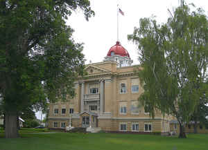
Richland County is a county located in the State of Montana. Based on the 2010 census, the population was 9,746. Its county seat is Sidney. Richland County was created 27 May 1914 from Dawson County. County seat: Sidney
Etymology - Origin of Richland County Name
Named in an attempt to lure in settlers
Demographics:
County QuickFacts: CensusBureau Quick Facts
Richland County History
Richland County was created by the Montana Legislature in 1914 from part of Dawson County. An early proposed name for the county was Gate, but Richland was decided upon instead as a way to entice new settlers
Geography: Land and Water
As reported by the Census Bureau, the county has a total area of 2,103 square miles (5,447 km2), of which,
2,084 square miles (5,398 km2) of it is land and 19 square miles (49 km2) of it (0.90%) is water.
Neighboring Counties
Bordering counties are as follows:
- Roosevelt County, Montana - north
- McCone County, Montana - west
- Dawson County, Montana - south
- Wibaux County, Montana - south
- McKenzie County, North Dakota - east
Education


Click Image to Enlarge
