


Click Image to Enlarge
Montana Counties
There are fifty-six counties in Montana. Montana has two consolidated city-counties- Anaconda with Deer Lodge County and Butte with Silver Bow County. The portion of Yellowstone National Park that lies within Montana was not part of any county until 1997, when part of it was nominally added to Gallatin County, and the rest of it to Park County.Sheridan County, Montana
Sheridan County Education, Geography, and History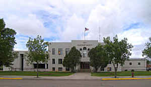
Sheridan County is a county located in the state of Montana. Based on the 2010 census, the population was 3,384. Its county seat is Plentywood. Sheridan County was established in 1913 when the Montana Legislature split Dawson and Valley Counties. It was named after American Civil War General Philip Sheridan. It is south from the Canadian border of Saskatchewan.
Etymology - Origin of Sheridan County Name
Philip Sheridan, Civil War general
Demographics:
County QuickFacts: CensusBureau Quick Facts
Sheridan County History
Sheridan County was created 24 March 1913 from Valley County. County seat: Plentywood
Geography: Land and Water
As reported by the Census Bureau, the county has a total area of 1,706 square miles (4,419 km2), of which,
1,677 square miles (4,342 km2) of it is land and 30 square miles (77 km2) of it (1.74%) is water.
Neighboring Counties
Bordering counties are as follows:
- Daniels County, Montana - west
- Roosevelt County, Montana - south
- Williams County, North Dakota - east
- Divide County, North Dakota - east
- Happy Valley No. 10, Saskatchewan - north
- Surprise Valley No. 9, Saskatchewan - north
- Lake Alma No. 8, Saskatchewan - north
Education


Click Image to Enlarge
