


Click Image to Enlarge
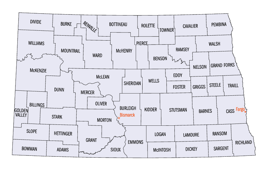
North Dakota Counties
There are fifty-three counties in the state of North Dakota. Pembina County was created by the 1866-1867 Dakota territorial legislature, and was organized on August 12, 1867. The city of Pembina, the oldest European-American settlement in the state, was the county seat from 1867 to 1911. The seat was relocated to Cavalier.Barnes County, North Dakota
Barnes County Education, Geography, and History
Barnes County is a county located in the state of North Dakota. Based on the 2010 census, the population was 11,066. The Dakota Territory's legislature authorized a Burbank County (named for governor John A. Burbank) in 1872. It was finally organized in a meeting at Valley City on January 6, 1879. Its county seat is Valley City.
Etymology - Origin of Barnes County Name
The Dakota Territory's legislature authorized a Burbank County (named for governor John A. Burbank) in 1872. But in 1874 they renamed it Barnes County in honor of Judge Alanson H. Barnes (1818-1890) who was an associate justice of the Territorial Court.
Demographics:
County QuickFacts:
Barnes County History
1873--Barnes County was created 4 January 1873 from Pembina County. County seat: Valley City
This county was created January 4, 1873- Originally the county was called Burbank, so named for John A. Burbank, governor of the territory
from 1869 to 1874, but by an act of the Legislature, July 14, 1874, the name was changed to Barnes in honor of Alphonso H. Barnes, who was an
associate justice of the territory at that time.
The first survey of lands in Barnes County was made by Charles Scott and Richard D. Chancy in 1872. Their work was approved by the surveyor
general in January, 1873, and filed in the land office at Pembina in September, 1873. The lands were made subject to preemption and
homesteading May 19, 1873.- The first settlers were at Valley City in 1872.
Geography: Land and Water
As reported by the Census Bureau, the county has a total area of 1,513 square miles (3,920 km2), of which 1,492 square miles (3,860 km2) is land and 22 square miles (57 km2) (1.4%) is water.
Neighboring Counties
Bordering counties are as follows:
- Griggs County (north)
- Steele County (northeast)
- Cass County (east)
- Ransom County (southeast)
- LaMoure County (southwest)
- Stutsman County (west)
Education


Click Image to Enlarge
